


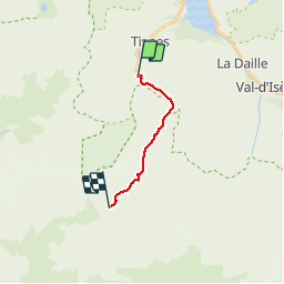
Tignes Val Claret Refuge de la leisse

epablo
User

Length
9.9 km

Max alt
2746 m

Uphill gradient
633 m
Km-Effort
17.2 km

Min alt
2134 m

Downhill gradient
291 m
Boucle
No
Creation date :
2019-07-14 08:41:09.166
Updated on :
2019-07-15 10:09:01.346
3h57
Difficulty : Medium

FREE GPS app for hiking
 SityTrail
IGN / Geographical institutes
SityTrail Plus
The world is yours!
About
Trail Walking of 9.9 km to be discovered at Auvergne-Rhône-Alpes, Savoy, Tignes. This trail is proposed by epablo.
Positioning
Country:
France
Region :
Auvergne-Rhône-Alpes
Department/Province :
Savoy
Municipality :
Tignes
Location:
Unknown
Start:(Dec)
Start:(UTM)
335817 ; 5035546 (32T) N.
Comments