


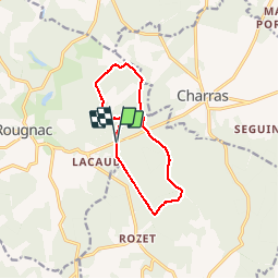
Forêt d'Horte 15-07-2019

jmrobin
User

Length
10.3 km

Max alt
220 m

Uphill gradient
175 m
Km-Effort
12.6 km

Min alt
158 m

Downhill gradient
179 m
Boucle
Yes
Creation date :
2019-07-15 13:15:10.728
Updated on :
2019-07-15 15:57:44.274
2h42
Difficulty : Very easy

FREE GPS app for hiking
 SityTrail
IGN / Geographical institutes
SityTrail Plus
The world is yours!
About
Trail Walking of 10.3 km to be discovered at New Aquitaine, Charente, Combiers. This trail is proposed by jmrobin.
Positioning
Country:
France
Region :
New Aquitaine
Department/Province :
Charente
Municipality :
Combiers
Location:
Unknown
Start:(Dec)
Start:(UTM)
296063 ; 5045453 (31T) N.
Comments