


Fort de Tamié

gil05
User

Length
4.2 km

Max alt
1017 m

Uphill gradient
140 m
Km-Effort
6.1 km

Min alt
905 m

Downhill gradient
152 m
Boucle
Yes
Creation date :
2019-07-17 07:30:08.0
Updated on :
2019-07-17 09:24:47.689
1h51
Difficulty : Easy

FREE GPS app for hiking
 SityTrail
IGN / Geographical institutes
SityTrail Plus
The world is yours!
About
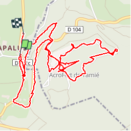
Trail Walking of 4.2 km to be discovered at Auvergne-Rhône-Alpes, Savoy, Plancherine. This trail is proposed by gil05.
Description
Visite du fort
Positioning
Country:
France
Region :
Auvergne-Rhône-Alpes
Department/Province :
Savoy
Municipality :
Plancherine
Location:
Unknown
Start:(Dec)
Start:(UTM)
290365 ; 5061228 (32T) N.
Comments