


M66 Laroque-des-Albères - ST GENIS

jeff66
User

Length
7.5 km

Max alt
92 m

Uphill gradient
57 m
Km-Effort
8.2 km

Min alt
44 m

Downhill gradient
57 m
Boucle
Yes
Creation date :
2019-07-17 06:58:08.0
Updated on :
2019-07-17 09:46:09.026
1h20
Difficulty : Medium

FREE GPS app for hiking
 SityTrail
IGN / Geographical institutes
SityTrail Plus
The world is yours!
About
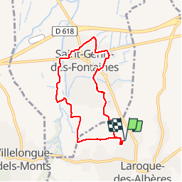
Trail Walking of 7.5 km to be discovered at Occitania, Pyrénées-Orientales, Laroque-des-Albères. This trail is proposed by jeff66.
Description
M66 LAROQUE-DES-ALBÈRES - chemin du mas rancoure - ST GENIS - le Riberal - stade- écoles - cave coop - La Prade - les vernèdes - Laroque-des-Albères - le 17.07.2019
Positioning
Country:
France
Region :
Occitania
Department/Province :
Pyrénées-Orientales
Municipality :
Laroque-des-Albères
Location:
Unknown
Start:(Dec)
Start:(UTM)
494298 ; 4708456 (31T) N.
Comments