


depart les aubert (champsaur)

gerardmicheline
User
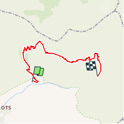

Length
12.1 km

Max alt
2673 m

Uphill gradient
1320 m
Km-Effort
29 km

Min alt
1476 m

Downhill gradient
993 m
Boucle
No
Creation date :
2019-07-17 13:54:07.731
Updated on :
2019-07-17 13:57:48.684
5h45
Difficulty : Very difficult

FREE GPS app for hiking
 SityTrail
IGN / Geographical institutes
SityTrail Plus
The world is yours!
About
Trail Walking of 12.1 km to be discovered at Provence-Alpes-Côte d'Azur, Hautes-Alpes, Champoléon. This trail is proposed by gerardmicheline.
Positioning
Country:
France
Region :
Provence-Alpes-Côte d'Azur
Department/Province :
Hautes-Alpes
Municipality :
Champoléon
Location:
Unknown
Start:(Dec)
Start:(UTM)
284786 ; 4960188 (32T) N.
Comments