


2019-07-18 Col de Vars

Bernardb44
User
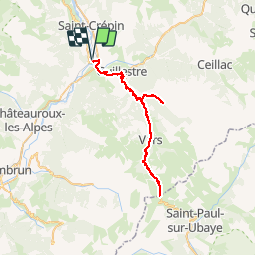

Length
66 km

Max alt
2112 m

Uphill gradient
1900 m
Km-Effort
91 km

Min alt
885 m

Downhill gradient
1900 m
Boucle
Yes
Creation date :
2019-07-18 07:16:19.464
Updated on :
2019-07-18 14:16:32.982
6h58
Difficulty : Difficult

FREE GPS app for hiking
 SityTrail
IGN / Geographical institutes
SityTrail Plus
The world is yours!
About
Trail Road bike of 66 km to be discovered at Provence-Alpes-Côte d'Azur, Hautes-Alpes, Eygliers. This trail is proposed by Bernardb44.
Positioning
Country:
France
Region :
Provence-Alpes-Côte d'Azur
Department/Province :
Hautes-Alpes
Municipality :
Eygliers
Location:
Unknown
Start:(Dec)
Start:(UTM)
310513 ; 4949366 (32T) N.
Comments