Lac Allos- Col petite cayole - Pas du Lausson

soca
User
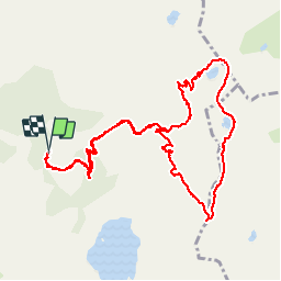

Length
12.5 km

Max alt
2675 m

Uphill gradient
612 m
Km-Effort
21 km

Min alt
2112 m

Downhill gradient
611 m
Boucle
Yes
Creation date :
2019-07-19 06:09:43.412
Updated on :
2019-07-19 18:55:41.262
5h26
Difficulty : Very easy

FREE GPS app for hiking
 SityTrail
IGN / Geographical institutes
SityTrail Plus
The world is yours!
About
Trail Walking of 12.5 km to be discovered at Provence-Alpes-Côte d'Azur, Alpes-de-Haute-Provence, Allos. This trail is proposed by soca.
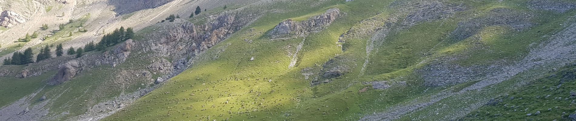
Photos


49 photos in total. Please click on a photo to see them all in the gallery.
Positioning
Country:
France
Region :
Provence-Alpes-Côte d'Azur
Department/Province :
Alpes-de-Haute-Provence
Municipality :
Allos
Location:
Unknown
Start:(Dec)
Start:(UTM)
316190 ; 4901653 (32T) N.
Comments