


Les lacs des Bouillouses

patbt
User
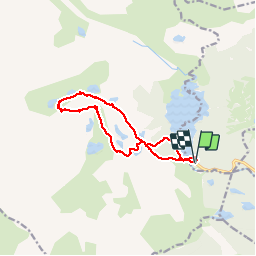

Length
12.2 km

Max alt
2355 m

Uphill gradient
396 m
Km-Effort
17.5 km

Min alt
2003 m

Downhill gradient
393 m
Boucle
Yes
Creation date :
2019-07-20 08:25:23.74
Updated on :
2019-07-20 16:40:01.538
6h46
Difficulty : Easy

FREE GPS app for hiking
 SityTrail
IGN / Geographical institutes
SityTrail Plus
The world is yours!
About
Trail Walking of 12.2 km to be discovered at Occitania, Pyrénées-Orientales, Les Angles. This trail is proposed by patbt.
Positioning
Country:
France
Region :
Occitania
Department/Province :
Pyrénées-Orientales
Municipality :
Les Angles
Location:
Unknown
Start:(Dec)
Start:(UTM)
418157 ; 4712328 (31T) N.
Comments