


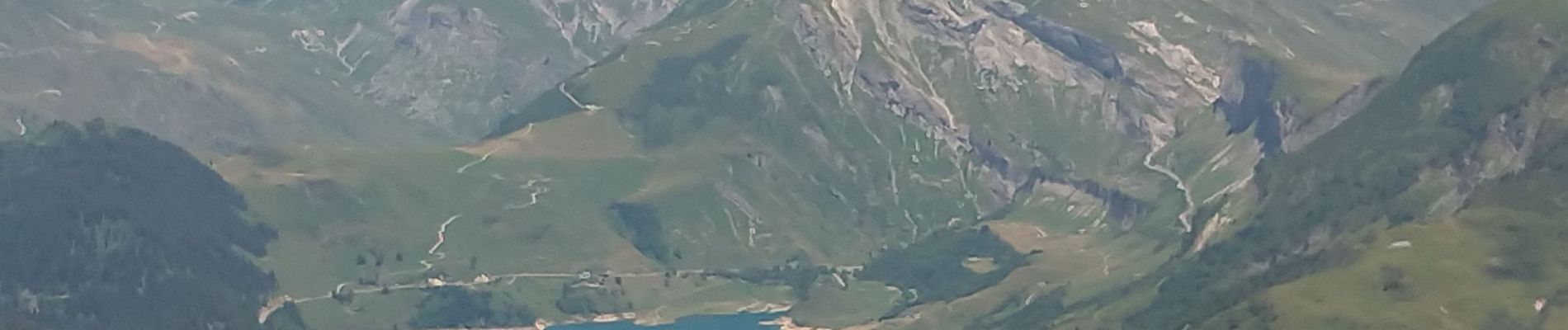
Areches le mont des accrays

chrifor
User
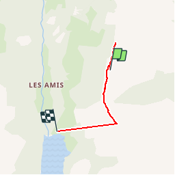

Length
3.6 km

Max alt
2163 m

Uphill gradient
140 m
Km-Effort
7 km

Min alt
1576 m

Downhill gradient
618 m
Boucle
No
Creation date :
2019-07-21 11:52:54.334
Updated on :
2019-07-21 17:08:31.22
1h53
Difficulty : Medium

FREE GPS app for hiking
 SityTrail
IGN / Geographical institutes
SityTrail Plus
The world is yours!
About
Trail Walking of 3.6 km to be discovered at Auvergne-Rhône-Alpes, Savoy, Beaufort. This trail is proposed by chrifor.
Photos


Positioning
Country:
France
Region :
Auvergne-Rhône-Alpes
Department/Province :
Savoy
Municipality :
Beaufort
Location:
Unknown
Start:(Dec)
Start:(UTM)
312633 ; 5059301 (32T) N.
Comments