Trail Walking Renauvoid - Circuit de Renauvoid - Photo

Circuit de Renauvoid

 tracegps
tracegps

User

© OpenStreetMap contributors
Length
Length
5.8 km
Max alt
Max alt
480 m
Uphill gradient
Uphill gradient
154 m
Km-Effort
Km-Effort  
7.8 km
Min alt
Min alt
406 m
Downhill gradient
Downhill gradient
155 m
Boucle
Boucle
Yes
Creation date :
2014-12-10 00:00:00.0
Updated on :
2014-12-10 00:00:00.0

(0 Reviews)

Walking
Walking
1h19
Difficulty : Medium

Scan this QR Code to open this trail in the SityTrail application

FREE GPS app for hiking

Logo SityTrail SityTrail

IGN / Geographical institutes

Download SityTrail from the App Store Download SityTrail from Google Play

Logo SityTrail SityTrail World

The world is yours!

Download SityTrail from the App Store Download SityTrail from Google Play Download SityTrail on Huawei AppGallery

About

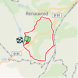
Trail Walking of 5.8 km to be discovered at Grand Est, Vosges, Renauvoid. This trail is proposed by tracegps.

Description

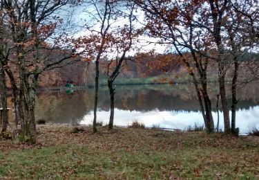
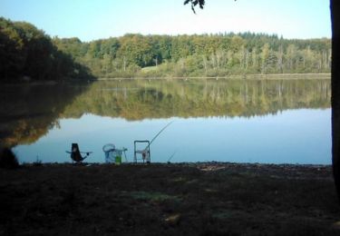
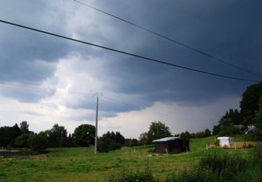
Circuit de 6km entre les champs et la forêt Vosgienne.

Elevation profile

Photos

Positioning

Country:
France
Region :
Grand Est
Department/Province :
Vosges
Municipality :
Renauvoid
Location:
Unknown
Start:(UTM)
304820 ; 5334316 (32U) N.

Trails nearby

Trail Walking Chaumousey - Bouzey, côté abbaye  - Photo
Walking
triburemy

Walking

Medium
Chaumousey, Grand Est, Vosges, France
6.1 km | 7.5 km-effort
1h 40min
Yes
Trail Walking Épinal - humbertois les ,2lacs - Photo
Walking
BernardHumeau

Walking

Medium
Épinal, Grand Est, Vosges, France
7.3 km | 8.9 km-effort
1h 55min
Yes
Trail Walking Chantraine - De Chantraine à Bouzey - Photo
Walking
jeanclaude12

Walking

Easy
Chantraine, Grand Est, Vosges, France
14.6 km | 18.2 km-effort
3h 47min
Yes
Trail Walking Sanchey - A la Découverte de BOUZEY - Photo
Walking
jeanclaude12

Walking

Very easy
Sanchey, Grand Est, Vosges, France
7.7 km | 9.3 km-effort
2h 4min
Yes
Trail Walking Épinal - Aux Champs de Damas - Photo
Walking
jeanclaude12

Walking

Easy
(2)
Épinal, Grand Est, Vosges, France
8.4 km | 10.3 km-effort
2h 17min
Yes
Trail Walking Sanchey - Circuit du tour du Lac de Bouzey - Photo
Walking
tracegps

Walking

Easy
Sanchey, Grand Est, Vosges, France
7 km | 8.5 km-effort
1h 40min
Yes
Trail Mountain bike Uriménil - Espace VTT FFC Chemins du Pays d'Epinal, Coeur des Vosges - circuit n°99 - Chapuis Chantré - Photo
Mountain bike
tracegps

Mountain bike

Difficult
Uriménil, Grand Est, Vosges, France
28 km | 36 km-effort
2h 15min
Yes
Trail Mountain bike Chaumousey - Espace VTT FFC Chemins du Coeur des Vosges - circuit n°87 - Circuit de l'Abbaye - Photo
Mountain bike
tracegps

Mountain bike

Medium
(1)
Chaumousey, Grand Est, Vosges, France
11.7 km | 14.8 km-effort
1h 0min
Yes
Trail Walking Chantraine - passée  - Photo
Walking
randolea

Walking

Medium
Chantraine, Grand Est, Vosges, France
5.7 km | 6.9 km-effort
1h 38min
Yes


Close
My subscriptions