Trail Walking Saint-Agrève - La Galoche 2013 - Saint Agrève - Photo

La Galoche 2013 - Saint Agrève

 tracegps
tracegps

User

© OpenStreetMap contributors
Length
Length
19.5 km
Max alt
Max alt
1067 m
Uphill gradient
Uphill gradient
684 m
Km-Effort
Km-Effort  
29 km
Min alt
Min alt
690 m
Downhill gradient
Downhill gradient
683 m
Boucle
Boucle
Yes
Creation date :
2014-12-10 00:00:00.0
Updated on :
2014-12-10 00:00:00.0

(0 Reviews)

Walking
Walking
5h00
Difficulty : Medium

Scan this QR Code to open this trail in the SityTrail application

FREE GPS app for hiking

Logo SityTrail SityTrail

IGN / Geographical institutes

Download SityTrail from the App Store Download SityTrail from Google Play

Logo SityTrail SityTrail World

The world is yours!

Download SityTrail from the App Store Download SityTrail from Google Play Download SityTrail on Huawei AppGallery

About

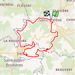
Trail Walking of 19.5 km to be discovered at Auvergne-Rhône-Alpes, Ardèche, Saint-Agrève. This trail is proposed by tracegps.

Description

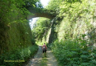
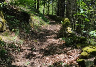
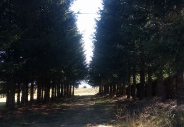
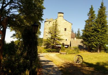
Retour par l'ancienne voie ferrée empruntée par La Galoche, viaducs, tunnels. Cette randonnée était organisée par le comité des fêtes de Saint Agrève (Ardèche), voici le lien de la manifestation . Samedi 3 juin : "La Galoche" - St Agrève/St Martin de Valamas Sillonnez la Vallée du Haut Eyrieux et ses ouvrages d’art puis remontez sur le plateau St Agrévois.

Elevation profile

Photos

Positioning

Country:
France
Region :
Auvergne-Rhône-Alpes
Department/Province :
Ardèche
Municipality :
Saint-Agrève
Location:
Unknown
Start:(UTM)
610023 ; 4984962 (31T) N.

Trails nearby

Trail Walking Saint-Jeure-d'Andaure - En pays d'Andaure - Photo
Walking
tracegps

Walking

Medium
(1)
Saint-Jeure-d'Andaure, Auvergne-Rhône-Alpes, Ardèche, France
6.8 km | 10.1 km-effort
2h 30min
Yes
Trail Walking Saint-Agrève - La chaux par les Sagnoles - Photo
Walking
mallovon

Walking

Medium
(1)
Saint-Agrève, Auvergne-Rhône-Alpes, Ardèche, France
6.4 km | 8.9 km-effort
2h 17min
Yes
Trail Walking Saint-Agrève - Le serre par le col de brun - Photo
Walking
mallovon

Walking

Easy
Saint-Agrève, Auvergne-Rhône-Alpes, Ardèche, France
4.1 km | 5.1 km-effort
1h 20min
Yes
Trail Mountain bike Saint-Agrève - Château de Flossac - Saint Agrève - Photo
Mountain bike
tracegps

Mountain bike

Medium
Saint-Agrève, Auvergne-Rhône-Alpes, Ardèche, France
14.5 km | 19.1 km-effort
2h 0min
Yes
Trail Walking Saint-Agrève - Château de Flossac - Saint Agrève - Photo
Walking
tracegps

Walking

Medium
Saint-Agrève, Auvergne-Rhône-Alpes, Ardèche, France
14.5 km | 19.1 km-effort
4h 0min
Yes
Trail Walking Saint-Julien-d'Intres - dolce via autour d'intres - Photo
Walking
Domdomii

Walking

Medium
Saint-Julien-d'Intres, Auvergne-Rhône-Alpes, Ardèche, France
5.9 km | 9 km-effort
1h 47min
Yes
Trail Walking Devesset - Tour du lac Devesset - Photo
Walking
DoChou

Walking

Very easy
Devesset, Auvergne-Rhône-Alpes, Ardèche, France
4.9 km | 5.8 km-effort
1h 18min
Yes
Trail Walking Devesset - le grail - Photo
Walking
berlan2

Walking

Very easy
Devesset, Auvergne-Rhône-Alpes, Ardèche, France
12 km | 0 m-effort
4h 2min
Yes
Trail Walking Devesset - Grand tour du lac de Devesset - Photo
Walking
tracegps

Walking

Medium
Devesset, Auvergne-Rhône-Alpes, Ardèche, France
8.8 km | 11.2 km-effort
2h 30min
Yes


Close
My subscriptions