


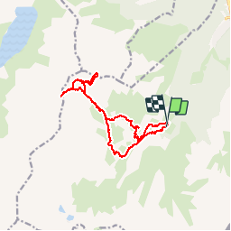
le lavoir / pointe des sarrasins

laurentnecca
User

Length
14.1 km

Max alt
2942 m

Uphill gradient
1133 m
Km-Effort
29 km

Min alt
1905 m

Downhill gradient
1138 m
Boucle
Yes
Creation date :
2019-07-24 06:17:28.532
Updated on :
2019-07-24 13:49:53.903
5h50
Difficulty : Very difficult

FREE GPS app for hiking
 SityTrail
IGN / Geographical institutes
SityTrail Plus
The world is yours!
About
Trail Walking of 14.1 km to be discovered at Auvergne-Rhône-Alpes, Savoy, Modane. This trail is proposed by laurentnecca.
Photos


Positioning
Country:
France
Region :
Auvergne-Rhône-Alpes
Department/Province :
Savoy
Municipality :
Modane
Location:
Unknown
Start:(Dec)
Start:(UTM)
313981 ; 5002144 (32T) N.
Comments