Trail Walking Jujurieux - Rando bugiste - Chenavel - Photo

Rando bugiste - Chenavel

 tracegps
tracegps

User

© OpenStreetMap contributors
Length
Length
23 km
Max alt
Max alt
407 m
Uphill gradient
Uphill gradient
575 m
Km-Effort
Km-Effort  
31 km
Min alt
Min alt
248 m
Downhill gradient
Downhill gradient
581 m
Boucle
Boucle
Yes
Creation date :
2014-12-10 00:00:00.0
Updated on :
2014-12-10 00:00:00.0

(0 Reviews)

Walking
Walking
5h00
Difficulty : Difficult

Scan this QR Code to open this trail in the SityTrail application

FREE GPS app for hiking

Logo SityTrail SityTrail

IGN / Geographical institutes

Download SityTrail from the App Store Download SityTrail from Google Play

Logo SityTrail SityTrail World

The world is yours!

Download SityTrail from the App Store Download SityTrail from Google Play Download SityTrail on Huawei AppGallery

About

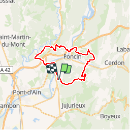
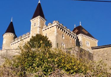
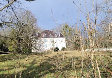
Trail Walking of 23 km to be discovered at Auvergne-Rhône-Alpes, Ain, Jujurieux. This trail is proposed by tracegps.

Description

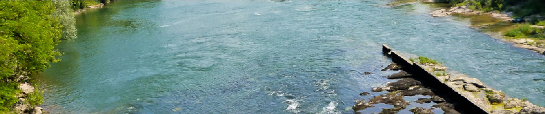
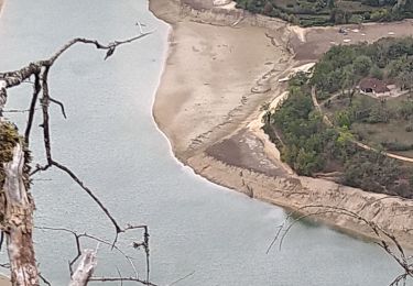
Balade dans les vignes du Cerdon puis passage au bord de l'Ain.

Elevation profile

Photos

Positioning

Country:
France
Region :
Auvergne-Rhône-Alpes
Department/Province :
Ain
Municipality :
Jujurieux
Location:
Unknown
Start:(UTM)
684780 ; 5103885 (31T) N.

Trails nearby

Trail Mountain bike Saint-Jean-le-Vieux - rando balcon de l'ain 40km - Photo
Mountain bike
Valery01

Mountain bike

Very easy
(2)
Saint-Jean-le-Vieux, Auvergne-Rhône-Alpes, Ain, France
38 km | 51 km-effort
3h 50min
Yes
Trail Walking Poncin - les bords de l ain depart povin - Photo
Walking
colomb24

Walking

Very difficult
Poncin, Auvergne-Rhône-Alpes, Ain, France
23 km | 32 km-effort
6h 25min
Yes
Trail Walking Jujurieux - 01-Jujurieux-Neuville-restau-18-7km-440m-fev22 - Photo
Walking
SyMA

Walking

Medium
Jujurieux, Auvergne-Rhône-Alpes, Ain, France
18.6 km | 25 km-effort
4h 54min
Yes
Trail Walking Saint-Jean-le-Vieux - forêt de Saint Jean - Photo
Walking
Frasco01

Walking

Very easy
Saint-Jean-le-Vieux, Auvergne-Rhône-Alpes, Ain, France
5.8 km | 9 km-effort
1h 41min
No
Trail Road bike Poncin - Circuit l'Ain à vélo n° 22 - Et au milieu coule une rivière... - Photo
Road bike
jpfrobert

Road bike

Very difficult
Poncin, Auvergne-Rhône-Alpes, Ain, France
59 km | 72 km-effort
4h 9min
No
Trail Walking Saint-Martin-du-Mont - St martin du mont - Photo
Walking
tippex01

Walking

Medium
(2)
Saint-Martin-du-Mont, Auvergne-Rhône-Alpes, Ain, France
10.9 km | 15 km-effort
3h 11min
Yes
Trail Walking Jujurieux - les châteaux de jujurieux  - Photo
Walking
colomb24

Walking

Easy
Jujurieux, Auvergne-Rhône-Alpes, Ain, France
14 km | 18.4 km-effort
4h 29min
Yes
Trail Walking Pont-d'Ain - pont d'ain château d'hterive - Photo
Walking
loca.yves

Walking

Difficult
Pont-d'Ain, Auvergne-Rhône-Alpes, Ain, France
15.1 km | 16.1 km-effort
3h 54min
Yes
Trail Walking Poncin - La Cueille - Cizod  - Photo
Walking
Jackoyo

Walking

Medium
Poncin, Auvergne-Rhône-Alpes, Ain, France
8.6 km | 12.8 km-effort
1h 56min
Yes


Close
My subscriptions