


col de clemens ou venasque

xav34830
User

Length
19.7 km

Max alt
2496 m

Uphill gradient
1315 m
Km-Effort
37 km

Min alt
1270 m

Downhill gradient
1316 m
Boucle
Yes
Creation date :
2019-07-24 05:33:26.687
Updated on :
2019-07-27 16:32:04.173
7h05
Difficulty : Difficult

FREE GPS app for hiking
 SityTrail
IGN / Geographical institutes
SityTrail Plus
The world is yours!
About
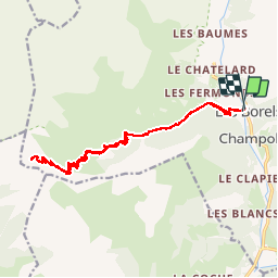
Trail Walking of 19.7 km to be discovered at Provence-Alpes-Côte d'Azur, Hautes-Alpes, Champoléon. This trail is proposed by xav34830.
Positioning
Country:
France
Region :
Provence-Alpes-Côte d'Azur
Department/Province :
Hautes-Alpes
Municipality :
Champoléon
Location:
Unknown
Start:(Dec)
Start:(UTM)
282815 ; 4955541 (32T) N.
Comments