


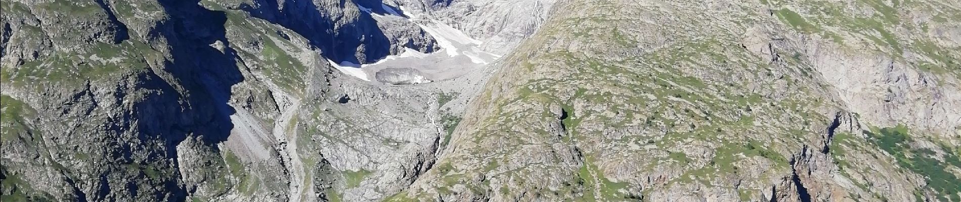
col du lautaret / lac d'arsine

laurentnecca
User
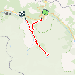

Length
20 km

Max alt
2462 m

Uphill gradient
613 m
Km-Effort
30 km

Min alt
1667 m

Downhill gradient
958 m
Boucle
No
Creation date :
2019-07-30 06:32:52.272
Updated on :
2019-07-30 16:07:42.929
6h27
Difficulty : Difficult

FREE GPS app for hiking
 SityTrail
IGN / Geographical institutes
SityTrail Plus
The world is yours!
About
Trail Walking of 20 km to be discovered at Provence-Alpes-Côte d'Azur, Hautes-Alpes, Villar-d'Arêne. This trail is proposed by laurentnecca.
Photos


Positioning
Country:
France
Region :
Provence-Alpes-Côte d'Azur
Department/Province :
Hautes-Alpes
Municipality :
Villar-d'Arêne
Location:
Unknown
Start:(Dec)
Start:(UTM)
295095 ; 4989913 (32T) N.
Comments