


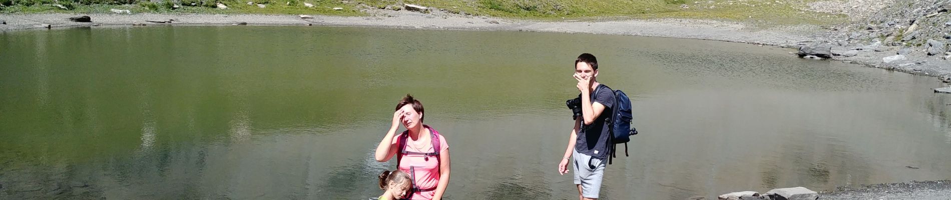
lac clair

Damien1271
User
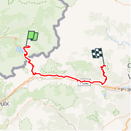

Length
77 km

Max alt
2764 m

Uphill gradient
1612 m
Km-Effort
102 km

Min alt
347 m

Downhill gradient
2668 m
Boucle
No
Creation date :
2019-07-31 11:33:03.315
Updated on :
2019-07-31 18:05:59.003
6h29
Difficulty : Very easy

FREE GPS app for hiking
 SityTrail
IGN / Geographical institutes
SityTrail Plus
The world is yours!
About
Trail Walking of 77 km to be discovered at Auvergne-Rhône-Alpes, Savoy, Val-Cenis. This trail is proposed by Damien1271.
Photos

Positioning
Country:
France
Region :
Auvergne-Rhône-Alpes
Department/Province :
Savoy
Municipality :
Val-Cenis
Location:
Lanslebourg-Mont-Cenis
Start:(Dec)
Start:(UTM)
339917 ; 5012214 (32T) N.
Comments