


SF 2019 - La Haute-Saintonge - P5

Lucquiaud
User

Length
189 km

Max alt
131 m

Uphill gradient
1852 m
Km-Effort
214 km

Min alt
3 m

Downhill gradient
1855 m
Boucle
Yes
Creation date :
2019-08-01 15:58:24.879
Updated on :
2019-08-01 15:58:52.509
--
Difficulty : Very easy

FREE GPS app for hiking
 SityTrail
IGN / Geographical institutes
SityTrail Plus
The world is yours!
About
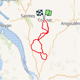
Trail Road bike of 189 km to be discovered at New Aquitaine, Charente, Cognac. This trail is proposed by Lucquiaud.
Positioning
Country:
France
Region :
New Aquitaine
Department/Province :
Charente
Municipality :
Cognac
Location:
Unknown
Start:(Dec)
Start:(UTM)
706905 ; 5063006 (30T) N.
Comments