


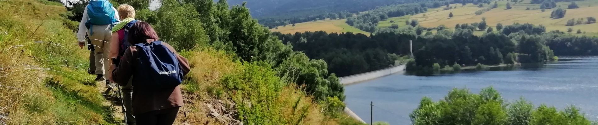
Esposolla - tour du lac de Puyvalador

vertygo
User
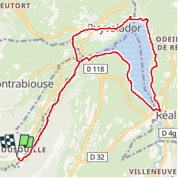

Length
12.2 km

Max alt
1536 m

Uphill gradient
217 m
Km-Effort
15.1 km

Min alt
1416 m

Downhill gradient
217 m
Boucle
Yes
Creation date :
2019-08-02 07:54:25.155
Updated on :
2019-08-15 18:34:46.48
3h21
Difficulty : Easy

FREE GPS app for hiking
 SityTrail
IGN / Geographical institutes
SityTrail Plus
The world is yours!
About
Trail Walking of 12.2 km to be discovered at Occitania, Pyrénées-Orientales, Fontrabiouse. This trail is proposed by vertygo.
Photos

Positioning
Country:
France
Region :
Occitania
Department/Province :
Pyrénées-Orientales
Municipality :
Fontrabiouse
Location:
Unknown
Start:(Dec)
Start:(UTM)
425893 ; 4719393 (31T) N.
Comments