Trail Walking Gemeinde Seefeld in Tirol - Mittenwald - Leutasch 210813 - Photo
© OpenStreetMap contributors
Length
Length
23 km
Max alt
Max alt
1352 m
Uphill gradient
Uphill gradient
590 m
Km-Effort
Km-Effort  
31 km
Min alt
Min alt
1133 m
Downhill gradient
Downhill gradient
626 m
Boucle
Boucle
No
Creation date :
2014-12-10 00:00:00.0
Updated on :
2014-12-10 00:00:00.0

(0 Reviews)

Walking
Walking
6h17
Difficulty : Unknown

Scan this QR Code to open this trail in the SityTrail application

FREE GPS app for hiking

Logo SityTrail SityTrail

IGN / Geographical institutes

Download SityTrail from the App Store Download SityTrail from Google Play

Logo SityTrail SityTrail World

The world is yours!

Download SityTrail from the App Store Download SityTrail from Google Play Download SityTrail on Huawei AppGallery

About

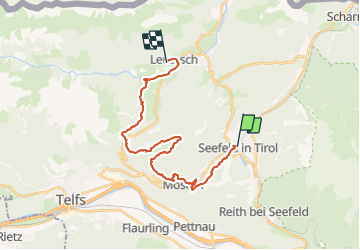
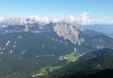
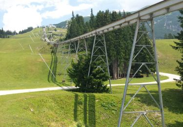
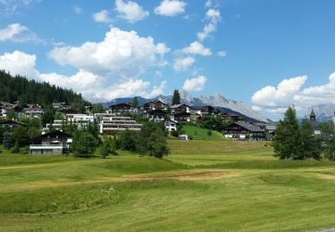
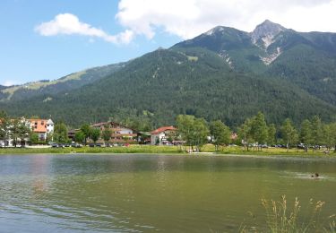
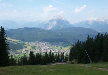
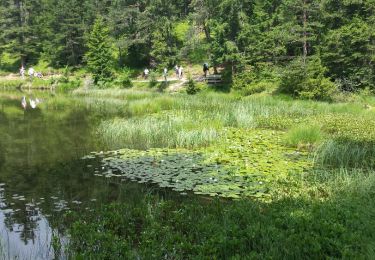
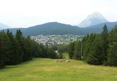
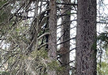
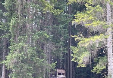
Trail Walking of 23 km to be discovered at Tyrol, Bezirk Innsbruck-Land, Gemeinde Seefeld in Tirol. This trail is proposed by thierry13710.

Elevation profile

Photos

Positioning

Country:
Austria
Region :
Tyrol
Department/Province :
Bezirk Innsbruck-Land
Municipality :
Gemeinde Seefeld in Tirol
Location:
Unknown
Start:(UTM)
665165 ; 5244134 (32T) N.

Trails nearby

Trail Walking Gemeinde Seefeld in Tirol - Les hauteurs de Seefeld - Photo
Walking
VacheKiri67

Walking

Medium
(1)
Gemeinde Seefeld in Tirol, Tyrol, Bezirk Innsbruck-Land, Austria
9.4 km | 14.1 km-effort
4h 37min
No
Trail Walking Gemeinde Seefeld in Tirol - Seefelder Spitze et pied de la Reither Spitze - Photo
Walking
VacheKiri67

Walking

Difficult
(2)
Gemeinde Seefeld in Tirol, Tyrol, Bezirk Innsbruck-Land, Austria
9.8 km | 18.2 km-effort
4h 53min
No
Trail Walking Gemeinde Seefeld in Tirol - Les lacs - Wildmoos - Möserersee - Photo
Walking
VacheKiri67

Walking

Easy
(1)
Gemeinde Seefeld in Tirol, Tyrol, Bezirk Innsbruck-Land, Austria
13.7 km | 18.4 km-effort
5h 31min
Yes
Trail Walking Gemeinde Seefeld in Tirol - Mösern - Gschwandtkopf - Reith - Photo
Walking
VacheKiri67

Walking

Medium
(1)
Gemeinde Seefeld in Tirol, Tyrol, Bezirk Innsbruck-Land, Austria
12.7 km | 19.2 km-effort
5h 2min
Yes
Trail Walking Gemeinde Seefeld in Tirol - Seefelder Spitze - Photo
Walking
VacheKiri67

Walking

Difficult
(1)
Gemeinde Seefeld in Tirol, Tyrol, Bezirk Innsbruck-Land, Austria
8.3 km | 13.2 km-effort
4h 49min
No
Trail Walking Gemeinde Seefeld in Tirol - Randonnée des 3 lacs sur le plateau de Seefeld - Photo
Walking
VacheKiri67

Walking

Medium
(1)
Gemeinde Seefeld in Tirol, Tyrol, Bezirk Innsbruck-Land, Austria
13.6 km | 18 km-effort
5h 28min
Yes
Trail Walking Gemeinde Seefeld in Tirol - Reitherjoch Alm - Photo
Walking
VacheKiri67

Walking

Medium
(1)
Gemeinde Seefeld in Tirol, Tyrol, Bezirk Innsbruck-Land, Austria
8.4 km | 13 km-effort
3h 52min
Yes
Trail Walking Gemeinde Seefeld in Tirol - W32_jpb - Photo
Walking
jpborto

Walking

Difficult
Gemeinde Seefeld in Tirol, Tyrol, Bezirk Innsbruck-Land, Austria
11.7 km | 16.2 km-effort
3h 52min
Yes
Trail Walking Gemeinde Seefeld in Tirol - W3_bis - Photo
Walking
jpborto

Walking

Medium
Gemeinde Seefeld in Tirol, Tyrol, Bezirk Innsbruck-Land, Austria
9.7 km | 13.1 km-effort
3h 11min
No


Close
My subscriptions