Trail Walking Les Plantiers - Rando Cœur Cévennes - Photo

Rando Cœur Cévennes

 mrclic34
mrclic34

User

© OpenStreetMap contributors
Length
Length
9.1 km
Max alt
Max alt
932 m
Uphill gradient
Uphill gradient
360 m
Km-Effort
Km-Effort  
13.9 km
Min alt
Min alt
604 m
Downhill gradient
Downhill gradient
347 m
Boucle
Boucle
Yes
Creation date :
2014-12-10 00:00:00.0
Updated on :
2014-12-10 00:00:00.0

(0 Reviews)

Walking
Walking
3h44
Difficulty : Very easy

Scan this QR Code to open this trail in the SityTrail application

FREE GPS app for hiking

Logo SityTrail SityTrail

IGN / Geographical institutes

Download SityTrail from the App Store Download SityTrail from Google Play

Logo SityTrail SityTrail World

The world is yours!

Download SityTrail from the App Store Download SityTrail from Google Play Download SityTrail on Huawei AppGallery

About

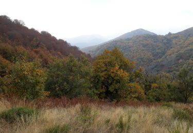
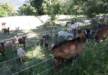
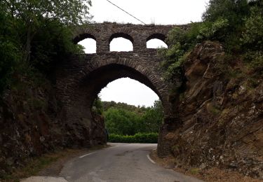
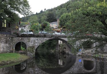
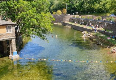
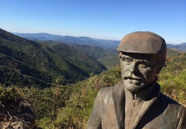
Trail Walking of 9.1 km to be discovered at Occitania, Gard, Les Plantiers. This trail is proposed by mrclic34.

Description

Très belle promenade au coeur des Cevennes. A ne pas louper si vous passez à coté.

Elevation profile

Photos

Positioning

Country:
France
Region :
Occitania
Department/Province :
Gard
Municipality :
Les Plantiers
Location:
Unknown
Start:(UTM)
556684 ; 4882867 (31T) N.

Trails nearby

Trail Walking Les Plantiers - Sentier de Saint Marcel de Fontfouillouse -  Les Plantiers - Photo
Walking
tracegps

Walking

Very difficult
(1)
Les Plantiers, Occitania, Gard, France
13.6 km | 21 km-effort
4h 0min
Yes
Trail Walking Les Plantiers - Vallée Borgne - Photo
Walking
GUIDE
nadinebondoux

Walking

Difficult
Les Plantiers, Occitania, Gard, France
19.7 km | 32 km-effort
5h 19min
Yes
Trail Walking Saumane - Exil / pont des chèvres  - Photo
Walking
GUIDE
nadinebondoux

Walking

Difficult
Saumane, Occitania, Gard, France
17.3 km | 27 km-effort
5h 53min
Yes
Trail Walking Les Plantiers - vallée Borgne - Photo
Walking
GUIDE
nadinebondoux

Walking

Difficult
Les Plantiers, Occitania, Gard, France
25 km | 36 km-effort
6h 15min
Yes
Trail Walking Les Plantiers - Les Plantiers et st Marcel de Fontfouillouse - Photo
Walking
GUIDE
randotines

Walking

Difficult
(1)
Les Plantiers, Occitania, Gard, France
13.6 km | 21 km-effort
4h 33min
Yes
Trail Walking Les Plantiers - Sentier du Mouflon - Les Plantiers  - Photo
Walking
GUIDE
randotines

Walking

Difficult
Les Plantiers, Occitania, Gard, France
11.2 km | 18.6 km-effort
3h 30min
Yes
Trail On foot Les Plantiers - Sentier de Fontfouillouse - Photo
On foot
PRO

On foot

Easy
Les Plantiers, Occitania, Gard, France
9.2 km | 15.2 km-effort
3h 27min
No
Trail Walking Les Plantiers - les plantiers, abbaye de Fontfouillouse  - Photo
Walking
francislassauce

Walking

Medium
Les Plantiers, Occitania, Gard, France
7.4 km | 11.8 km-effort
3h 16min
Yes
Trail Walking Val-d'Aigoual - Col d’asclier rocher de l’aigle  - Photo
Walking
GUIDE
antignacs

Walking

Very difficult
Val-d'Aigoual, Occitania, Gard, France
20 km | 30 km-effort
6h 10min
Yes


Close
My subscriptions