


Col vanoise glacier patinoire

prof_physique
User
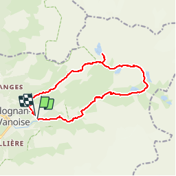

Length
15.1 km

Max alt
2576 m

Uphill gradient
1202 m
Km-Effort
31 km

Min alt
1649 m

Downhill gradient
1176 m
Boucle
Yes
Creation date :
2019-08-08 07:45:04.0
Updated on :
2019-08-08 14:53:58.826
6h32
Difficulty : Unknown

FREE GPS app for hiking
 SityTrail
IGN / Geographical institutes
SityTrail Plus
The world is yours!
About
Trail Walking of 15.1 km to be discovered at Auvergne-Rhône-Alpes, Savoy, Pralognan-la-Vanoise. This trail is proposed by prof_physique.
Description
Lac patinoire magnifique avec son glacier
Randonnée très sympa avec des vues sur tous les glaciers
Positioning
Country:
France
Region :
Auvergne-Rhône-Alpes
Department/Province :
Savoy
Municipality :
Pralognan-la-Vanoise
Location:
Unknown
Start:(Dec)
Start:(UTM)
322739 ; 5027785 (32T) N.
Comments