


cime du sambuis et lacs sambuis et lacroix

bymarc26
User
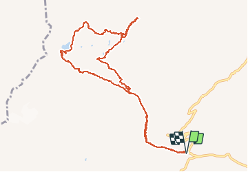

Length
12.6 km
Boucle
Yes
Creation date :
2019-08-08 07:15:28.326
Updated on :
2019-08-08 16:14:48.446
7h56
Difficulty : Very difficult

FREE GPS app for hiking
 SityTrail
IGN / Geographical institutes
SityTrail Plus
The world is yours!
About
Trail Walking of 12.6 km to be discovered at Auvergne-Rhône-Alpes, Savoy, Saint-Colomban-des-Villards. This trail is proposed by bymarc26.
Positioning
Country:
France
Region :
Auvergne-Rhône-Alpes
Department/Province :
Savoy
Municipality :
Saint-Colomban-des-Villards
Location:
Unknown
Start:(Dec)
Start:(UTM)
278287 ; 5013428 (32T) N.
Comments