


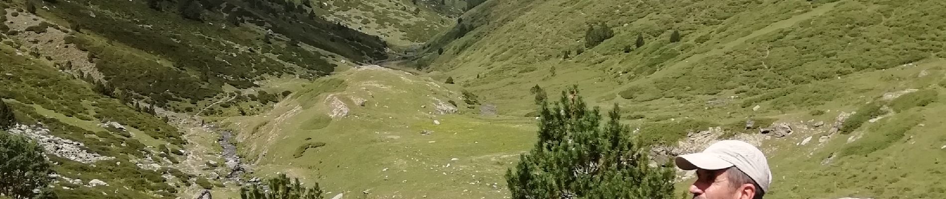
Vallée d'Eyne

vertygo
User
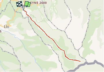

Length
16 km

Max alt
2518 m

Uphill gradient
918 m
Km-Effort
28 km

Min alt
1603 m

Downhill gradient
917 m
Boucle
Yes
Creation date :
2019-08-15 19:22:23.968
Updated on :
2019-08-15 19:45:56.341
6h00
Difficulty : Difficult

FREE GPS app for hiking
 SityTrail
IGN / Geographical institutes
SityTrail Plus
The world is yours!
About
Trail Walking of 16 km to be discovered at Occitania, Pyrénées-Orientales, Eyne. This trail is proposed by vertygo.
Description
retracé car GPX perdu
Photos

Positioning
Country:
France
Region :
Occitania
Department/Province :
Pyrénées-Orientales
Municipality :
Eyne
Location:
Unknown
Start:(Dec)
Start:(UTM)
424541 ; 4702304 (31T) N.
Comments