


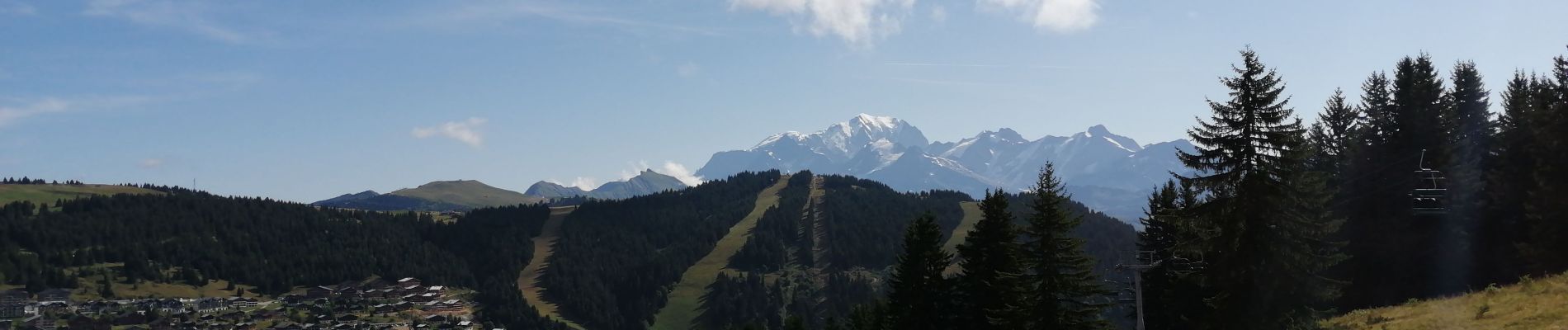
sous Bisanne au lac des Saisies

syl_34
User
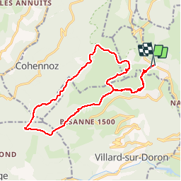

Length
18.1 km

Max alt
1821 m

Uphill gradient
741 m
Km-Effort
28 km

Min alt
1481 m

Downhill gradient
730 m
Boucle
Yes
Creation date :
2019-08-16 07:52:51.058
Updated on :
2019-08-16 13:57:16.242
5h36
Difficulty : Medium

FREE GPS app for hiking
 SityTrail
IGN / Geographical institutes
SityTrail Plus
The world is yours!
About
Trail Walking of 18.1 km to be discovered at Auvergne-Rhône-Alpes, Savoy, Hauteluce. This trail is proposed by syl_34.
Description
Belle rando avec très belle vue
Photos


Positioning
Country:
France
Region :
Auvergne-Rhône-Alpes
Department/Province :
Savoy
Municipality :
Hauteluce
Location:
Unknown
Start:(Dec)
Start:(UTM)
308455 ; 5069948 (32T) N.
Comments
Belle rando, pas de difficultées particulières. Très beau point de vue.