Trail Walking Unknown - Wilcox Pass 2376 m - Photo
 GOHIER
GOHIER

User

© OpenStreetMap contributors
Length
Length
7.8 km
Max alt
Max alt
2365 m
Uphill gradient
Uphill gradient
369 m
Km-Effort
Km-Effort  
12.7 km
Min alt
Min alt
2014 m
Downhill gradient
Downhill gradient
364 m
Boucle
Boucle
Yes
Creation date :
2019-08-15 20:13:52.0
Updated on :
2019-08-17 15:54:17.632

(0 Reviews)

Walking
Walking
3h24
Difficulty : Unknown

Scan this QR Code to open this trail in the SityTrail application

FREE GPS app for hiking

Logo SityTrail SityTrail

IGN / Geographical institutes

Download SityTrail from the App Store Download SityTrail from Google Play

Logo SityTrail SityTrail World

The world is yours!

Download SityTrail from the App Store Download SityTrail from Google Play Download SityTrail on Huawei AppGallery

About

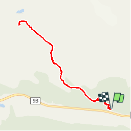
Trail Walking of 7.8 km to be discovered at Alberta, Improvement District No. 12. This trail is proposed by GOHIER.

Description

Forêt puis lande, pozzines et mouflons d’Amerique.

Elevation profile

Positioning

Country:
Canada
Region :
Alberta
Department/Province :
Improvement District No. 12
Municipality :
Unknown
Location:
Unknown
Start:(UTM)
487376 ; 5785326 (11U) N.

Trails nearby

Trail Walking  - Wikiloc - Sentier du Col Wilcox - Photo
Walking
GUIDE
Alizée.pee

Walking

Difficult
, Alberta, Improvement District No. 12, Canada
10.7 km | 17 km-effort
3h 30min
Yes
Trail Walking  - Parker Ridge - Photo
Walking
GOHIER

Walking

, Alberta, Improvement District No. 9, Canada
11.3 km | 16.7 km-effort
2h 39min
No
Trail Car  - Attabacca à Lake Louise - Photo
Car
GOHIER

Car

, Alberta, Improvement District No. 12, Canada
156 km | 186 km-effort
6h 16min
No


Close
My subscriptions