


Ancelle col de combeau 850m 16km

StephaneBM
User
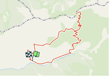

Length
12.2 km

Max alt
2300 m

Uphill gradient
812 m
Km-Effort
23 km

Min alt
1496 m

Downhill gradient
816 m
Boucle
Yes
Creation date :
2019-08-18 11:37:40.018
Updated on :
2019-08-18 11:37:40.018
--
Difficulty : Unknown

FREE GPS app for hiking
 SityTrail
IGN / Geographical institutes
SityTrail Plus
The world is yours!
About
Trail Mountain bike of 12.2 km to be discovered at Provence-Alpes-Côte d'Azur, Hautes-Alpes, Ancelle. This trail is proposed by StephaneBM.
Positioning
Country:
France
Region :
Provence-Alpes-Côte d'Azur
Department/Province :
Hautes-Alpes
Municipality :
Ancelle
Location:
Unknown
Start:(Dec)
Start:(UTM)
281111 ; 4944958 (32T) N.
Comments