


Raid VTT 2019CMCAS pays de savoie - Jour 1

StephaneBM
User
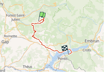

Length
47 km

Max alt
2295 m

Uphill gradient
1006 m
Km-Effort
64 km

Min alt
756 m

Downhill gradient
2068 m
Boucle
No
Creation date :
2019-08-19 12:19:19.273
Updated on :
2019-08-19 17:29:39.182
5h09
Difficulty : Difficult

FREE GPS app for hiking
 SityTrail
IGN / Geographical institutes
SityTrail Plus
The world is yours!
About
Trail Mountain bike of 47 km to be discovered at Provence-Alpes-Côte d'Azur, Hautes-Alpes, Ancelle. This trail is proposed by StephaneBM.
Description
démarrage en retard et arrêt une fois au centre... désolé !
Positioning
Country:
France
Region :
Provence-Alpes-Côte d'Azur
Department/Province :
Hautes-Alpes
Municipality :
Ancelle
Location:
Unknown
Start:(Dec)
Start:(UTM)
281225 ; 4945701 (32T) N.
Comments