Trail Walking Cervières - Le Petit rochebrune par col de péas - Photo

Le Petit rochebrune par col de péas

 amiral13
amiral13

User GUIDE

© OpenStreetMap contributors
Length
Length
15.2 km
Max alt
Max alt
3060 m
Uphill gradient
Uphill gradient
1158 m
Km-Effort
Km-Effort  
31 km
Min alt
Min alt
2045 m
Downhill gradient
Downhill gradient
1159 m
Boucle
Boucle
Yes
Creation date :
2019-08-21 07:24:12.401
Updated on :
2019-08-21 19:45:48.14

(0 Reviews)

Walking
Walking
8h08
Difficulty : Difficult

Scan this QR Code to open this trail in the SityTrail application

FREE GPS app for hiking

Logo SityTrail SityTrail

IGN / Geographical institutes

Download SityTrail from the App Store Download SityTrail from Google Play

Logo SityTrail SityTrail World

The world is yours!

Download SityTrail from the App Store Download SityTrail from Google Play Download SityTrail on Huawei AppGallery

About

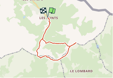
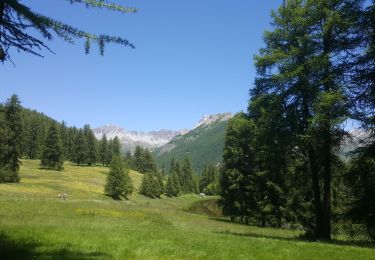
Trail Walking of 15.2 km to be discovered at Provence-Alpes-Côte d'Azur, Hautes-Alpes, Cervières. This trail is proposed by amiral13.

Description

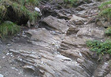
attention la majorité de cette randonnée s'effectue hors sentier. En arête du col de Péas au sommet du petit rochebrune. La descente se fait d'abord par l'arête puis dans des pentes instables pour rejoindre des pentes herbeuses qu'il faudra parcourir sur plusieurs kilomètres.

Elevation profile

Photos

Positioning

Country:
France
Region :
Provence-Alpes-Côte d'Azur
Department/Province :
Hautes-Alpes
Municipality :
Cervières
Location:
Unknown
Start:(UTM)
327370 ; 4968058 (32T) N.

Trails nearby

Trail Walking Cervières - le lac des Cordes et le pic du vallon Crouzet - Photo
Walking
GUIDE
amiral13

Walking

Easy
Cervières, Provence-Alpes-Côte d'Azur, Hautes-Alpes, France
11.8 km | 22 km-effort
4h 26min
Yes
Trail Walking Cervières - le lasseron col de chaude maison  - Photo
Walking
Evenc

Walking

Difficult
Cervières, Provence-Alpes-Côte d'Azur, Hautes-Alpes, France
13.3 km | 28 km-effort
9h 54min
Yes
Trail Walking Cervières - Le Lac des cordes  - Photo
Walking
Sorriaux

Walking

Difficult
Cervières, Provence-Alpes-Côte d'Azur, Hautes-Alpes, France
10 km | 18.7 km-effort
3h 42min
No
Trail Walking Cervières - Arsem Les fonts de Cervieres - Photo
Walking
labarone

Walking

Medium
Cervières, Provence-Alpes-Côte d'Azur, Hautes-Alpes, France
13.4 km | 23 km-effort
5h 44min
No
Trail Winter toboggan Cervières - refuge Les Fonts à Chalp - Photo
Winter toboggan
jeff2

Winter toboggan

Difficult
Cervières, Provence-Alpes-Côte d'Azur, Hautes-Alpes, France
22 km | 35 km-effort
7h 1min
No
Trail Walking Cervières - Lac des Cordes - Photo
Walking
Jacques-WIRTH

Walking

Difficult
Cervières, Provence-Alpes-Côte d'Azur, Hautes-Alpes, France
3.2 km | 8.2 km-effort
1h 44min
No
Trail Walking Cervières - Lac des Cordes - Photo
Walking
gfk49

Walking

Difficult
Cervières, Provence-Alpes-Côte d'Azur, Hautes-Alpes, France
6 km | 12.9 km-effort
3h 7min
Yes
Trail Walking Cervières - Lacs et Col du Bousson. 04 10.15 - Photo
Walking
Dervalmarc

Walking

Easy
Cervières, Provence-Alpes-Côte d'Azur, Hautes-Alpes, France
8.1 km | 12.3 km-effort
2h 24min
Yes
Trail Walking Cervières - Lacs et Col de Bousson. 04 10.15 - Photo
Walking
Dervalmarc

Walking

Easy
(1)
Cervières, Provence-Alpes-Côte d'Azur, Hautes-Alpes, France
8.1 km | 12.3 km-effort
2h 24min
Yes


Close
My subscriptions