Trail Walking Labelle - Wikiloc - Lac-Caribou - Cap 360° - Photo

Wikiloc - Lac-Caribou - Cap 360°

 Alizée.pee
Alizée.pee

User GUIDE

© OpenStreetMap contributors
Length
Length
5.8 km
Max alt
Max alt
446 m
Uphill gradient
Uphill gradient
205 m
Km-Effort
Km-Effort  
8.6 km
Min alt
Min alt
266 m
Downhill gradient
Downhill gradient
206 m
Boucle
Boucle
Yes
Creation date :
2019-08-23 13:20:56.658
Updated on :
2019-08-23 13:24:32.24

(0 Reviews)

Walking
Walking
1h47
Difficulty : Medium

Scan this QR Code to open this trail in the SityTrail application

FREE GPS app for hiking

Logo SityTrail SityTrail

IGN / Geographical institutes

Download SityTrail from the App Store Download SityTrail from Google Play

Logo SityTrail SityTrail World

The world is yours!

Download SityTrail from the App Store Download SityTrail from Google Play Download SityTrail on Huawei AppGallery

About

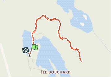
Trail Walking of 5.8 km to be discovered at Quebec, Les Laurentides, Labelle. This trail is proposed by Alizée.pee.

Description

Magnifique randonnée avec passage par le petit lac du Caribou. Beaux paysages et points de vues au sommet. Randonnée pas trop longue et très sympathique !

Elevation profile

Positioning

Country:
Canada
Region :
Quebec
Department/Province :
Les Laurentides
Municipality :
Labelle
Location:
Unknown
Start:(UTM)
521796 ; 5127141 (18T) N.

Trails nearby

Trail Walking Labelle - 2014-05-25 16:07:40 - Photo
Walking
GUIDE
Alizée.pee

Walking

Very difficult
(1)
Labelle, Quebec, Les Laurentides, Canada
17.3 km | 28 km-effort
6h 40min
Yes
Trail Canoe - kayak Labelle - Rivière Rouge - Photo
Canoe - kayak
DaVinci

Canoe - kayak

Medium
Labelle, Quebec, Les Laurentides, Canada
25 km | 27 km-effort
4h 10min
No


Close
My subscriptions