Trail Walking Soultzeren - Les 4 lacs entre le Tanet et le col du Calvaire - Photo

Les 4 lacs entre le Tanet et le col du Calvaire

 oscar1
oscar1

User

© OpenStreetMap contributors
Length
Length
19.7 km
Max alt
Max alt
1304 m
Uphill gradient
Uphill gradient
854 m
Km-Effort
Km-Effort  
31 km
Min alt
Min alt
950 m
Downhill gradient
Downhill gradient
855 m
Boucle
Boucle
Yes
Creation date :
2019-08-24 07:16:32.635
Updated on :
2019-08-25 10:32:35.546

(1 Reviews)

Walking
Walking
6h47
Difficulty : Difficult

Scan this QR Code to open this trail in the SityTrail application

FREE GPS app for hiking

Logo SityTrail SityTrail

IGN / Geographical institutes

Download SityTrail from the App Store Download SityTrail from Google Play

Logo SityTrail SityTrail Plus

The world is yours!

Download SityTrail from the App Store Download SityTrail from Google Play Download SityTrail on Huawei AppGallery

About

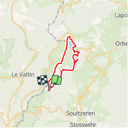
Trail Walking of 19.7 km to be discovered at Grand Est, Haut-Rhin, Soultzeren. This trail is proposed by oscar1.

Description

Un aperçu des 4 lacs en une journée. Difficile de part  la durée et la distance, et la descente entre le Rocher Hans et le lac Blanc. Très beau point de vue des lacs Noir , Blanc et surtout le lac des Truites depuis les crêtes. Le lac Vert quant à lui est magnifique de part sa couleur.  Pour ceux qui ne connaissent pas la région, ce parcours peut être raccourci à tout moment.  

Elevation profile

Photos

Positioning

Country:
France
Region :
Grand Est
Department/Province :
Haut-Rhin
Municipality :
Soultzeren
Location:
Unknown
Start:(UTM)
355548 ; 5327397 (32U) N.

Comments

Please log in to post a review or rate the element


Close
My subscriptions