


Le tour du Thannenwald 15/20

argonneuweg
User
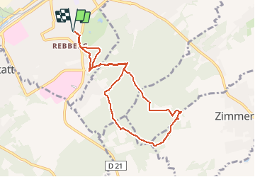

Length
8.5 km

Max alt
370 m

Uphill gradient
193 m
Km-Effort
11.1 km

Min alt
275 m

Downhill gradient
194 m
Boucle
Yes
Creation date :
2019-08-25 08:57:36.0
Updated on :
2019-09-23 19:25:23.185
1h53
Difficulty : Medium

FREE GPS app for hiking
 SityTrail
IGN / Geographical institutes
SityTrail Plus
The world is yours!
About
Trail Walking of 8.5 km to be discovered at Grand Est, Haut-Rhin, Mulhouse. This trail is proposed by argonneuweg.
Description
Jolie balade ombragée
Positioning
Country:
France
Region :
Grand Est
Department/Province :
Haut-Rhin
Municipality :
Mulhouse
Location:
Unknown
Start:(Dec)
Start:(UTM)
375946 ; 5288087 (32T) N.
Comments