Trail Hybrid bike Quint-Fonsegrives - Entre Saune  et Sausse - Photo
 mipi31
mipi31

User

© OpenStreetMap contributors
Length
Length
51 km
Max alt
Max alt
247 m
Uphill gradient
Uphill gradient
522 m
Km-Effort
Km-Effort  
58 km
Min alt
Min alt
129 m
Downhill gradient
Downhill gradient
522 m
Boucle
Boucle
Yes
Creation date :
2019-08-26 07:23:04.322
Updated on :
2019-08-28 21:24:00.494

(0 Reviews)

Hybrid bike
Hybrid bike
3h17
Difficulty : Medium

Scan this QR Code to open this trail in the SityTrail application

FREE GPS app for hiking

Logo SityTrail SityTrail

IGN / Geographical institutes

Download SityTrail from the App Store Download SityTrail from Google Play

Logo SityTrail SityTrail World

The world is yours!

Download SityTrail from the App Store Download SityTrail from Google Play Download SityTrail on Huawei AppGallery

About

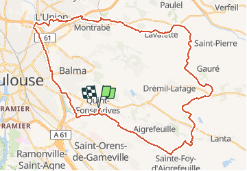
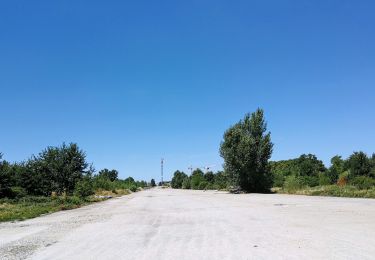
Trail Hybrid bike of 51 km to be discovered at Occitania, Haute-Garonne, Quint-Fonsegrives. This trail is proposed by mipi31.

Description

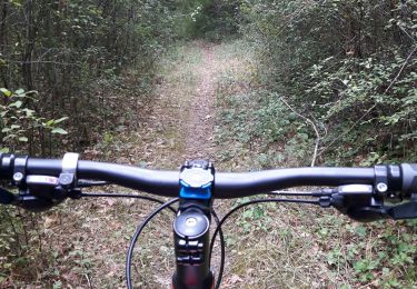
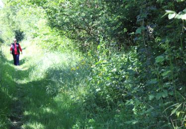
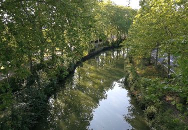
Sentiers et pistes cyclables sur le plat pour la première moitié du circuit, puis on quitte la vallée de la Sausse pour monter à Lavalette. A partir de là c'est plus vallonné. On emprunte ensuite des routes avec très peu de circulation  avec quand même quelques passages sur piste jusqu'au retour dans la vallée de la Saune au niveau du lac de Sainte Foy d'Aigrefeuille  où on retrouve la piste à plat jusqu'à la fin.

Elevation profile

Photos

Positioning

Country:
France
Region :
Occitania
Department/Province :
Haute-Garonne
Municipality :
Quint-Fonsegrives
Location:
Unknown
Start:(UTM)
381534 ; 4826715 (31T) N.

Trails nearby

Trail Hybrid bike Quint-Fonsegrives - Sainte-Foy d'Aigrefeuille Teulat Gragnague - Photo
Hybrid bike
mipi31

Hybrid bike

Medium
Quint-Fonsegrives, Occitania, Haute-Garonne, France
57 km | 69 km-effort
3h 52min
Yes
Trail Walking Auzielle - Auzielle 2 petits boucles en VTT - Photo
Walking
Laurent3129

Walking

Difficult
Auzielle, Occitania, Haute-Garonne, France
14.9 km | 17.4 km-effort
3h 48min
Yes
Trail Walking Ramonville-Saint-Agne - TT19 - Ramonville - Photo
Walking

Walking

Medium
Ramonville-Saint-Agne, Occitania, Haute-Garonne, France
9.4 km | 10.5 km-effort
2h 21min
No
Trail Walking Toulouse - Cité de l'Espace - Photo
Walking

Walking

Easy
Toulouse, Occitania, Haute-Garonne, France
11.1 km | 12.2 km-effort
2h 30min
No
Trail Walking Ramonville-Saint-Agne - Les 2 rives du canal à Ramonville - Photo
Walking
zazibelle

Walking

Easy
Ramonville-Saint-Agne, Occitania, Haute-Garonne, France
6 km | 6.6 km-effort
1h 30min
Yes
Trail Walking Toulouse - Chateau de l'Hers - Balma - Photo
Walking
tracegps

Walking

Medium
Toulouse, Occitania, Haute-Garonne, France
3.5 km | 3.8 km-effort
1h 0min
Yes
Trail Running Toulouse - Des coteaux au Canal du Midi - Photo
Running
tracegps

Running

Very difficult
Toulouse, Occitania, Haute-Garonne, France
36 km | 45 km-effort
3h 19min
Yes
Trail Mountain bike Toulouse - Des coteaux au Canal du Midi - Photo
Mountain bike
tracegps

Mountain bike

Difficult
Toulouse, Occitania, Haute-Garonne, France
36 km | 45 km-effort
2h 30min
Yes
Trail Walking Toulouse - Des coteaux au Canal du Midi - Photo
Walking
tracegps

Walking

Very difficult
Toulouse, Occitania, Haute-Garonne, France
36 km | 45 km-effort
7h 0min
Yes


Close
My subscriptions