


73 - BONNEVAL-SUR-ARC

AndreLACOMBE
User
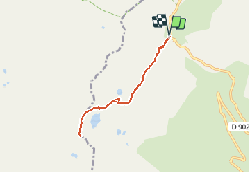

Length
6.9 km

Max alt
3047 m

Uphill gradient
503 m
Km-Effort
13.7 km

Min alt
2531 m

Downhill gradient
510 m
Boucle
Yes
Creation date :
2019-08-26 08:03:38.698
Updated on :
2019-08-26 14:16:34.742
5h11
Difficulty : Medium

FREE GPS app for hiking
 SityTrail
IGN / Geographical institutes
SityTrail Plus
The world is yours!
About
Trail Walking of 6.9 km to be discovered at Auvergne-Rhône-Alpes, Savoy, Bonneval-sur-Arc. This trail is proposed by AndreLACOMBE.
Description
Parking au Pont de la Neige. Montée au lac du Grand Fond, au col des Fours (2976 m) et à la Pointe des Fours (3072.m). Retour par le même itinéraire.
Positioning
Country:
France
Region :
Auvergne-Rhône-Alpes
Department/Province :
Savoy
Municipality :
Bonneval-sur-Arc
Location:
Unknown
Start:(Dec)
Start:(UTM)
345623 ; 5029976 (32T) N.
Comments