Trail Running Stockach - test hors ligne - Photo
 Doubotis
Doubotis

User ADMIN

© OpenStreetMap contributors
Length
Length
4.6 km
Max alt
Max alt
464 m
Uphill gradient
Uphill gradient
48 m
Km-Effort
Km-Effort  
5.1 km
Min alt
Min alt
426 m
Downhill gradient
Downhill gradient
26 m
Boucle
Boucle
No
Creation date :
2019-08-26 14:09:49.991
Updated on :
2019-08-26 14:17:13.138

(0 Reviews)

Running
Running
6m
Difficulty : Very easy

Scan this QR Code to open this trail in the SityTrail application

FREE GPS app for hiking

Logo SityTrail SityTrail

IGN / Geographical institutes

Download SityTrail from the App Store Download SityTrail from Google Play

Logo SityTrail SityTrail World

The world is yours!

Download SityTrail from the App Store Download SityTrail from Google Play Download SityTrail on Huawei AppGallery

About

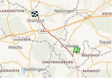
Trail Running of 4.6 km to be discovered at Baden-Württemberg, Landkreis Konstanz, Stockach. This trail is proposed by Doubotis.

Elevation profile

Positioning

Country:
Germany
Region :
Baden-Württemberg
Department/Province :
Landkreis Konstanz
Municipality :
Stockach
Location:
Unknown
Start:(UTM)
497772 ; 5295062 (32T) N.

Trails nearby

Trail Walking Stockach - wahlwies - Photo
Walking
Tommy Eric

Walking

Medium
Stockach, Baden-Württemberg, Landkreis Konstanz, Germany
6.4 km | 7.4 km-effort
1h 55min
No
Trail Trail Orsingen-Nenzingen - tghh - Photo
Trail
Doubotis

Trail

Very easy
(1)
Orsingen-Nenzingen, Baden-Württemberg, Landkreis Konstanz, Germany
775 m | 1 km-effort
1min
No


Close
My subscriptions