10.7 km | 11.7 km-effort
mon
JPS73
User
Length
6.9 km
Max alt
13 m
Uphill gradient
13 m
Km-Effort
7.1 km
Min alt
0 m
Downhill gradient
23 m
Boucle
No
Creation date :
2019-08-27 08:15:05.151
Updated on :
2019-08-27 12:06:42.675
3h11
Difficulty : Very easy
FREE GPS app for hiking
About
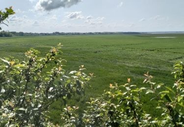
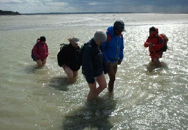
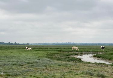
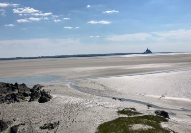
Trail Walking of 6.9 km to be discovered at Normandy, Manche, Genêts. This trail is proposed by JPS73.
Description
M'ont SM
Positioning
Country:
France
Region :
Normandy
Department/Province :
Manche
Municipality :
Genêts
Location:
Unknown
Start:(Dec)
Start:(UTM)
610621 ; 5393824 (30U) N.
Comments
Trails nearby
genets 3 juin 2017
Walking
Easy
(2)
Genêts,
Normandy,
Manche,
France
13 km | 14.2 km-effort
3h 8min
Yes
La Baie du Mont Saint Michel
Walking
Medium
Genêts,
Normandy,
Manche,
France
13.1 km | 13.3 km-effort
3h 3min
Yes
Pointe du Grouin Sud - Marcey les Grèves
Walking
Easy
Vains,
Normandy,
Manche,
France
11.8 km | 12.5 km-effort
3h 21min
Yes
Genêts - la pointe du groin sud
Walking
Easy
Genêts,
Normandy,
Manche,
France
11.9 km | 12.9 km-effort
3h 26min
Yes
Le Bec d’Andaine
Walking
Easy
Dragey-Ronthon,
Normandy,
Manche,
France
10.2 km | 11.2 km-effort
3h 1min
Yes
Baie Mont Saint Michel
Walking
Easy
Genêts,
Normandy,
Manche,
France
13.1 km | 13.3 km-effort
3h 0min
Yes
groin du Sud dragey en alle retour par les greves
Running
Very easy
Vains,
Normandy,
Manche,
France
16.8 km | 17.8 km-effort
1h 40min
Yes