


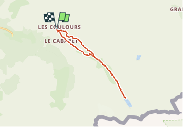
73 - BRAMANS - Col du Petit Mont-Cenis

AndreLACOMBE
User

Length
12.7 km

Max alt
2450 m

Uphill gradient
459 m
Km-Effort
18.8 km

Min alt
2182 m

Downhill gradient
459 m
Boucle
Yes
Creation date :
2019-08-27 08:11:26.844
Updated on :
2019-08-27 15:20:07.875
5h59
Difficulty : Difficult

FREE GPS app for hiking
 SityTrail
IGN / Geographical institutes
SityTrail Plus
The world is yours!
About
Trail Walking of 12.7 km to be discovered at Auvergne-Rhône-Alpes, Savoy, Val-Cenis. This trail is proposed by AndreLACOMBE.
Description
Départ par les lacs Perrin. Pour rejoindre la vallée du ruisseau de Savine, descente technique sécurisée par câbles. Montée au lac Savine et retour direct à la voiture.
Positioning
Country:
France
Region :
Auvergne-Rhône-Alpes
Department/Province :
Savoy
Municipality :
Val-Cenis
Location:
Bramans
Start:(Dec)
Start:(UTM)
332379 ; 5008572 (32T) N.
Comments