


MODANE

AndreLACOMBE
User
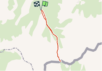

Length
6.4 km

Max alt
2554 m

Uphill gradient
460 m
Km-Effort
12.5 km

Min alt
2088 m

Downhill gradient
460 m
Boucle
Yes
Creation date :
2019-08-28 10:43:03.851
Updated on :
2019-08-28 16:36:44.977
2h43
Difficulty : Easy

FREE GPS app for hiking
 SityTrail
IGN / Geographical institutes
SityTrail Plus
The world is yours!
About
Trail Walking of 6.4 km to be discovered at Auvergne-Rhône-Alpes, Savoy, Modane. This trail is proposed by AndreLACOMBE.
Description
Depuis Fontaine Froide, montée au col de la Roue.
Positioning
Country:
France
Region :
Auvergne-Rhône-Alpes
Department/Province :
Savoy
Municipality :
Modane
Location:
Unknown
Start:(Dec)
Start:(UTM)
313716 ; 5001015 (32T) N.
Comments