


73 -TERMIGNON - Bellecombe.

AndreLACOMBE
User

Length
8.7 km

Max alt
2450 m

Uphill gradient
302 m
Km-Effort
12.7 km

Min alt
2277 m

Downhill gradient
303 m
Boucle
Yes
Creation date :
2019-08-30 08:11:51.434
Updated on :
2019-08-30 13:17:35.007
4h01
Difficulty : Medium

FREE GPS app for hiking
 SityTrail
IGN / Geographical institutes
SityTrail Plus
The world is yours!
About
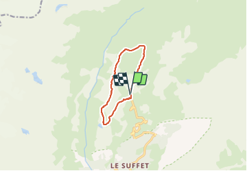
Trail Walking of 8.7 km to be discovered at Auvergne-Rhône-Alpes, Savoy, Val-Cenis. This trail is proposed by AndreLACOMBE.
Description
Boucle au départ du parking de Bellecombe par le lac Blanc, les lacs de Bellecombe, le lac du Lait et Plan du lac.
Positioning
Country:
France
Region :
Auvergne-Rhône-Alpes
Department/Province :
Savoy
Municipality :
Val-Cenis
Location:
Termignon
Start:(Dec)
Start:(UTM)
329887 ; 5021807 (32T) N.
Comments