


Wittersdorf

Derrendinger
User
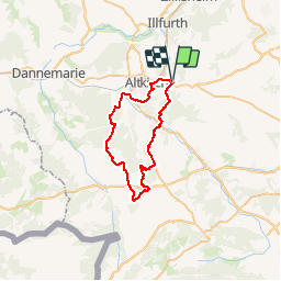

Length
39 km

Max alt
446 m

Uphill gradient
700 m
Km-Effort
48 km

Min alt
279 m

Downhill gradient
701 m
Boucle
Yes
Creation date :
2019-09-01 08:42:40.0
Updated on :
2019-09-01 11:30:17.701
2h46
Difficulty : Medium

FREE GPS app for hiking
 SityTrail
IGN / Geographical institutes
SityTrail Plus
The world is yours!
About
Trail Mountain bike of 39 km to be discovered at Grand Est, Haut-Rhin, Wittersdorf. This trail is proposed by Derrendinger.
Description
Rando sympa
Positioning
Country:
France
Region :
Grand Est
Department/Province :
Haut-Rhin
Municipality :
Wittersdorf
Location:
Unknown
Start:(Dec)
Start:(UTM)
370253 ; 5275877 (32T) N.
Comments