Trail Walking Ville de Saguenay - La Baie sentier Eucher - Photo

La Baie sentier Eucher

 Alizée.pee
Alizée.pee

User GUIDE

© OpenStreetMap contributors
Length
Length
6 km
Max alt
Max alt
156 m
Uphill gradient
Uphill gradient
315 m
Km-Effort
Km-Effort  
10.2 km
Min alt
Min alt
3 m
Downhill gradient
Downhill gradient
315 m
Boucle
Boucle
Yes
Creation date :
2019-09-02 11:38:03.204
Updated on :
2019-09-02 11:39:08.049

(0 Reviews)

Walking
Walking
2h05
Difficulty : Medium

Scan this QR Code to open this trail in the SityTrail application

FREE GPS app for hiking

Logo SityTrail SityTrail

IGN / Geographical institutes

Download SityTrail from the App Store Download SityTrail from Google Play

Logo SityTrail SityTrail World

The world is yours!

Download SityTrail from the App Store Download SityTrail from Google Play Download SityTrail on Huawei AppGallery

About

Trail Walking of 6 km to be discovered at Quebec, Unknown, Ville de Saguenay. This trail is proposed by Alizée.pee.

Description

Magnifique randonnée qui vous offre une vue sur la rivière Saguenay, très joli ! De nombreux points de vue. Un bon dénivelé mais qui permet d’avoir de beaux paysages.

Elevation profile

Positioning

Country:
Canada
Region :
Quebec
Department/Province :
Unknown
Municipality :
Ville de Saguenay
Location:
Unknown
Start:(UTM)
361769 ; 5357702 (19U) N.

Trails nearby

Trail Walking Ville de Saguenay - Rando La Baie Québec - Photo
Walking
TRIMAILLE

Walking

Medium
Ville de Saguenay, Quebec, Unknown, Canada
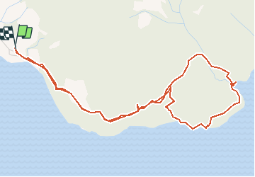
6.2 km | 10.7 km-effort
2h 10min
Yes


Close
My subscriptions