


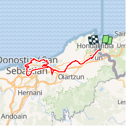

10.1 km | 17.1 km-effort

User


FREE GPS app for hiking
 SityTrail
IGN / Geographical institutes
SityTrail World
The world is yours!
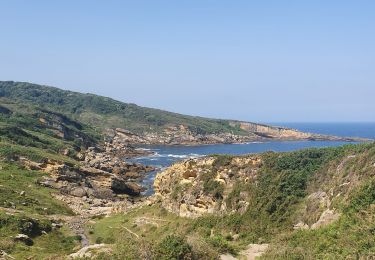
Trail Walking of 54 km to be discovered at New Aquitaine, Pyrénées-Atlantiques, Hendaye. This trail is proposed by jaja64.
Mix Train / Rando. Départ Topo (Eusko Tren) gare d'Hendaye. 5 € 30 le billet AR.
(Les parkings autour de la gare sont payants. Vous trouverez des places gratuites vers la piscine).
Il y a un train toutes les 30 mn. Descendre à la station Herrera. Direction le port. Pour le retour Gare d'Amarada Donostia centre.


Walking

Walking
Walking

Walking
Walking

Walking
On foot
Walking
Walking