


Ch. Freundstein - FA Ostein

regisbodilis
User

Length
10 km

Max alt
952 m

Uphill gradient
450 m
Km-Effort
16 km

Min alt
626 m

Downhill gradient
452 m
Boucle
Yes
Creation date :
2014-12-10 00:00:00.0
Updated on :
2014-12-10 00:00:00.0
4h00
Difficulty : Easy

FREE GPS app for hiking
 SityTrail
IGN / Geographical institutes
SityTrail Plus
The world is yours!
About
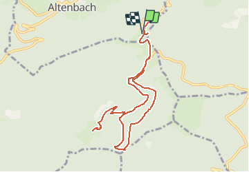
Trail Walking of 10 km to be discovered at Grand Est, Haut-Rhin, Goldbach-Altenbach. This trail is proposed by regisbodilis.
Description
Chateau - (rectangle rouge-blanc) FA Freundstein - chapelle Freundstein - FA Ostein - rocher d'Ostein - retour sur le chateau
Positioning
Country:
France
Region :
Grand Est
Department/Province :
Haut-Rhin
Municipality :
Goldbach-Altenbach
Location:
Unknown
Start:(Dec)
Start:(UTM)
359580 ; 5303393 (32T) N.
Comments