


Essai FA RIED FA BUCHWALD TL 09/19

patrickbeyrath
User
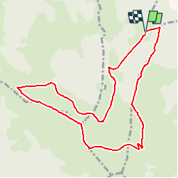

Length
10 km

Max alt
1170 m

Uphill gradient
387 m
Km-Effort
15.1 km

Min alt
893 m

Downhill gradient
387 m
Boucle
Yes
Creation date :
2019-09-08 07:59:35.231
Updated on :
2019-09-08 09:44:50.311
--
Difficulty : Medium

FREE GPS app for hiking
 SityTrail
IGN / Geographical institutes
SityTrail Plus
The world is yours!
About
Trail On foot of 10 km to be discovered at Grand Est, Haut-Rhin, Luttenbach-près-Munster. This trail is proposed by patrickbeyrath.
Positioning
Country:
France
Region :
Grand Est
Department/Province :
Haut-Rhin
Municipality :
Luttenbach-près-Munster
Location:
Unknown
Start:(Dec)
Start:(UTM)
360850 ; 5318447 (32U) N.
Comments