Trail Walking Lacroix-Falgarde - ARCEP Lacroix Falgarde gleysette - Photo

ARCEP Lacroix Falgarde gleysette

 VACHER31
VACHER31

User

© OpenStreetMap contributors
Length
Length
8.3 km
Max alt
Max alt
257 m
Uphill gradient
Uphill gradient
175 m
Km-Effort
Km-Effort  
10.6 km
Min alt
Min alt
147 m
Downhill gradient
Downhill gradient
172 m
Boucle
Boucle
Yes
Creation date :
2019-09-08 12:39:27.019
Updated on :
2019-09-08 15:36:26.861

(0 Reviews)

Walking
Walking
1h47
Difficulty : Very easy

Scan this QR Code to open this trail in the SityTrail application

FREE GPS app for hiking

Logo SityTrail SityTrail

IGN / Geographical institutes

Download SityTrail from the App Store Download SityTrail from Google Play

Logo SityTrail SityTrail World

The world is yours!

Download SityTrail from the App Store Download SityTrail from Google Play Download SityTrail on Huawei AppGallery

About

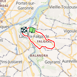
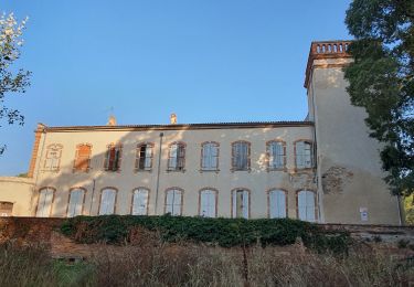
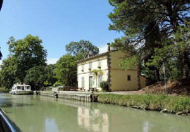
Trail Walking of 8.3 km to be discovered at Occitania, Haute-Garonne, Lacroix-Falgarde. This trail is proposed by VACHER31.

Description

Boucle, un passage à gué et descente un peu raide avec escaliers

Elevation profile

Positioning

Country:
France
Region :
Occitania
Department/Province :
Haute-Garonne
Municipality :
Lacroix-Falgarde
Location:
Unknown
Start:(UTM)
371071 ; 4817834 (31T) N.

Trails nearby

Trail Walking Saubens - Saubens falaise Villate - Photo
Walking
pidjam

Walking

Very easy
(2)
Saubens, Occitania, Haute-Garonne, France
8.9 km | 10 km-effort
2h 11min
Yes
Trail Mountain bike Pins-Justaret - De Pins Justaret à Clermont Le Fort - Photo
Mountain bike
tracegps

Mountain bike

Medium
(1)
Pins-Justaret, Occitania, Haute-Garonne, France
30 km | 35 km-effort
2h 30min
Yes
Trail Mountain bike Aureville - Aureville à Goyrans - Photo
Mountain bike
tracegps

Mountain bike

Medium
(1)
Aureville, Occitania, Haute-Garonne, France
14.9 km | 19.4 km-effort
1h 0min
Yes
Trail Walking Aureville - Aureville à Goyrans - Photo
Walking
tracegps

Walking

Medium
(1)
Aureville, Occitania, Haute-Garonne, France
14.9 km | 19.4 km-effort
3h 0min
Yes
Trail On foot Clermont-le-Fort - Boucle de Notre-Dame des Bois - Photo
On foot
PRO

On foot

Easy
Clermont-le-Fort, Occitania, Haute-Garonne, France
10.9 km | 14.1 km-effort
3h 12min
Yes
Trail Walking Clermont-le-Fort - L'Ariège de Clermont Le Fort à Vénerque - Photo
Walking
tracegps

Walking

Medium
(2)
Clermont-le-Fort, Occitania, Haute-Garonne, France
9.2 km | 12.2 km-effort
2h 0min
Yes
Trail Walking Pinsaguel - PINSAGUEL : sentier de la Confluence (24.08.2023) - Photo
Walking
chrisgps

Walking

Very easy
Pinsaguel, Occitania, Haute-Garonne, France
3.8 km | 4.4 km-effort
1h 15min
Yes
Trail Electric bike Roquettes - 2019_12_03 Miremont - Photo
Electric bike
albaultjl

Electric bike

Medium
(1)
Roquettes, Occitania, Haute-Garonne, France
54 km | 60 km-effort
2h 38min
Yes
Trail Cycle Roques - Canal du midi de Roques à carcassonne  - Photo
Cycle
destras

Cycle

Easy
Roques, Occitania, Haute-Garonne, France
106 km | 116 km-effort
6h 39min
No


Close
My subscriptions