Trail Walking Pontis - Pic du Morgon par Serre-Chiret - Photo
 David25400
David25400

User GUIDE

© OpenStreetMap contributors
Length
Length
14 km
Max alt
Max alt
2282 m
Uphill gradient
Uphill gradient
1016 m
Km-Effort
Km-Effort  
27 km
Min alt
Min alt
1308 m
Downhill gradient
Downhill gradient
1001 m
Boucle
Boucle
Yes
Creation date :
2019-09-08 13:24:15.705
Updated on :
2019-09-08 17:26:41.049

(0 Reviews)

Walking
Walking
4h02
Difficulty : Difficult

Scan this QR Code to open this trail in the SityTrail application

FREE GPS app for hiking

Logo SityTrail SityTrail

IGN / Geographical institutes

Download SityTrail from the App Store Download SityTrail from Google Play

Logo SityTrail SityTrail World

The world is yours!

Download SityTrail from the App Store Download SityTrail from Google Play Download SityTrail on Huawei AppGallery

About

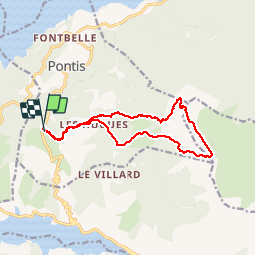
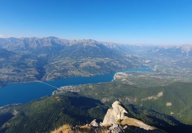
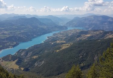
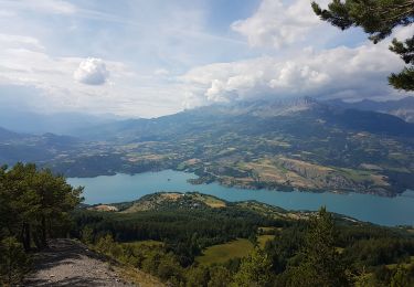
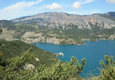
Trail Walking of 14 km to be discovered at Provence-Alpes-Côte d'Azur, Alpes-de-Haute-Provence, Pontis. This trail is proposed by David25400.

Description

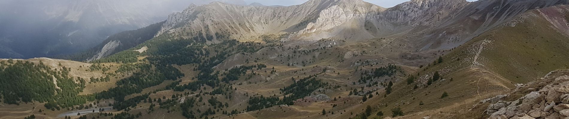
Hors sentier à partir du ravin, très forte montée sur la crête herbeuse

Elevation profile

Photos

Positioning

Country:
France
Region :
Provence-Alpes-Côte d'Azur
Department/Province :
Alpes-de-Haute-Provence
Municipality :
Pontis
Location:
Unknown
Start:(UTM)
289242 ; 4929621 (32T) N.

Trails nearby

Trail Walking Ubaye-Serre-Ponçon - Circuit de l'Escoubaye 25 -12- 2014 - Photo
Walking
Dervalmarc

Walking

Easy
(1)
Ubaye-Serre-Ponçon, Provence-Alpes-Côte d'Azur, Alpes-de-Haute-Provence, France
6.9 km | 10.1 km-effort
2h 32min
Yes
Trail Walking Chorges - Chanteloube et lac de Serre Ponçon - Photo
Walking
gildascb

Walking

Very easy
(2)
Chorges, Provence-Alpes-Côte d'Azur, Hautes-Alpes, France
5.9 km | 8.2 km-effort
1h 47min
Yes
Trail Walking Pontis - PONTIS , le dolmen  - Photo
Walking
RobinMicheline

Walking

Medium
(1)
Pontis, Provence-Alpes-Côte d'Azur, Alpes-de-Haute-Provence, France
12.9 km | 21 km-effort
3h 50min
Yes
Trail Walking Pontis - Le Grand Morgon par la face nord 07/09/23 - Photo
Walking
GUIDE
R@ph

Walking

Difficult
Pontis, Provence-Alpes-Côte d'Azur, Alpes-de-Haute-Provence, France
7.8 km | 18.9 km-effort
4h 18min
Yes
Trail Walking Pontis - Morgon par les Traverses, retour par les Ortals - Photo
Walking
GUIDE
David25400

Walking

Very difficult
Pontis, Provence-Alpes-Côte d'Azur, Alpes-de-Haute-Provence, France
17.1 km | 33 km-effort
5h 49min
No
Trail Walking Pontis - Morgon par les Ortals - Photo
Walking
GUIDE
David25400

Walking

Difficult
Pontis, Provence-Alpes-Côte d'Azur, Alpes-de-Haute-Provence, France
15.6 km | 32 km-effort
6h 29min
Yes
Trail Mountain bike Savines-le-Lac - circuit de serre verger N°25 - Photo
Mountain bike
guariso

Mountain bike

Medium
(1)
Savines-le-Lac, Provence-Alpes-Côte d'Azur, Hautes-Alpes, France
9.8 km | 15.8 km-effort
1h 30min
No
Trail Walking Ubaye-Serre-Ponçon - L'Escoubaye - Photo
Walking
FERAUD

Walking

Medium
(1)
Ubaye-Serre-Ponçon, Provence-Alpes-Côte d'Azur, Alpes-de-Haute-Provence, France
6 km | 9 km-effort
1h 22min
Yes
Trail Walking Pontis - Tour du Morgonnet - Photo
Walking
andre06130

Walking

Easy
(1)
Pontis, Provence-Alpes-Côte d'Azur, Alpes-de-Haute-Provence, France
3.4 km | 5.5 km-effort
1h 14min
Yes


Close
My subscriptions