


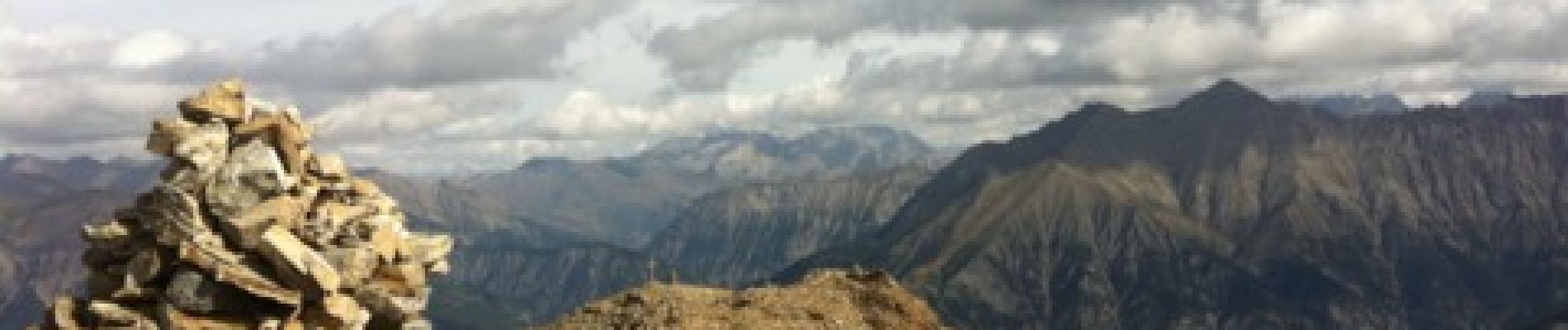
Croix de l Alpe

ytenag
User
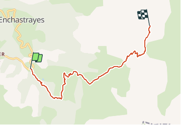

Length
6.7 km

Max alt
2592 m

Uphill gradient
928 m
Km-Effort
16.1 km

Min alt
1682 m

Downhill gradient
37 m
Boucle
No
Creation date :
2014-12-10 00:00:00.0
Updated on :
2014-12-10 00:00:00.0
2h11
Difficulty : Medium

FREE GPS app for hiking
 SityTrail
IGN / Geographical institutes
SityTrail Plus
The world is yours!
About
Trail Walking of 6.7 km to be discovered at Provence-Alpes-Côte d'Azur, Alpes-de-Haute-Provence, Enchastrayes. This trail is proposed by ytenag.
Photos


Positioning
Country:
France
Region :
Provence-Alpes-Côte d'Azur
Department/Province :
Alpes-de-Haute-Provence
Municipality :
Enchastrayes
Location:
Unknown
Start:(Dec)
Start:(UTM)
316616 ; 4913869 (32T) N.
Comments
Belle vue sur toute la vallée une fois en haut et sur le vallon de terres-pleines, mais la première partie jusqu'à la bergerie se fait sur les pistes de ski. Pas vraiment de sensation haute montagne.