Enchastrayes, Alpes-de-Haute-Provence: Best trails, routes and walks

9 comments

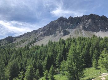
Enchastrayes: Discover the best trails: 59 hiking trails and 12 bike and mountain-bike routes. All these trails, routes and outdoor activities are available in our SityTrail applications for smartphones and tablets.
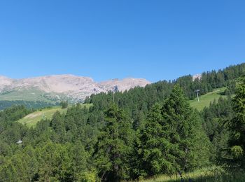
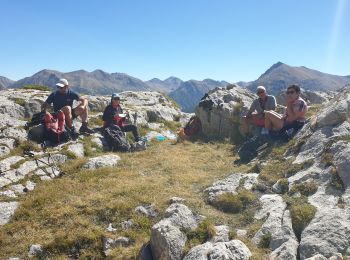
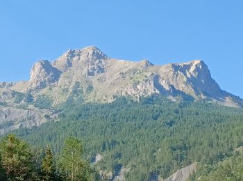
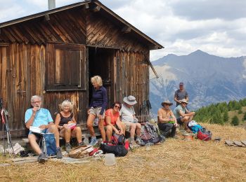

The best trails (90)

Trail Walking Enchastrayes - chapeau de gendarme. Ubaye  - Photo
Walking 16.031
Km

Walking

Difficult
(1)
Enchastrayes, Provence-Alpes-Côte d'Azur, Alpes-de-Haute-Provence, France
16 km | 31 km-effort
7h 30min
1155 m
1152 m
Yes
ytenag

Trail Walking Enchastrayes - PETIT TOUR A BARCELONNETTE - Photo
Walking 7.294
Km

Walking

Medium
Enchastrayes, Provence-Alpes-Côte d'Azur, Alpes-de-Haute-Provence, France
7.3 km | 8.8 km-effort
2h 20min
112 m
110 m
Yes
walrou63

Trail Walking Enchastrayes - chapeau de gendarme - Photo
Walking 13.502
Km

Walking

Medium
Enchastrayes, Provence-Alpes-Côte d'Azur, Alpes-de-Haute-Provence, France
13.5 km | 28 km-effort
6h 51min
1080 m
1080 m
Yes
gibello

Trail Walking Enchastrayes - Aupillon-cabane basse 04 - Photo
Walking 11.068
Km

Walking

Difficult
Enchastrayes, Provence-Alpes-Côte d'Azur, Alpes-de-Haute-Provence, France
11.1 km | 18 km-effort
3h 24min
521 m
524 m
Yes
janussity

Trail Walking Enchastrayes - col du Chapeau de gendarme et de Gyp Aller via flanc est Retour via flanc nord - Photo
Walking 11.377
Km

Walking

Difficult
Enchastrayes, Provence-Alpes-Côte d'Azur, Alpes-de-Haute-Provence, France
11.4 km | 25 km-effort
4h 29min
1009 m
1005 m
Yes
cyrgab

Trail Walking Enchastrayes - Chapeaux du gendarme (20/08/2021) - Photo
Walking 17.111
Km

Walking

Very difficult
Enchastrayes, Provence-Alpes-Côte d'Azur, Alpes-de-Haute-Provence, France
17.1 km | 33 km-effort
6h 24min
1208 m
1212 m
Yes
manumax

Trail Walking Enchastrayes - col des alaris - Photo
Walking 14.593
Km

Walking

Medium
Enchastrayes, Provence-Alpes-Côte d'Azur, Alpes-de-Haute-Provence, France
14.6 km | 24 km-effort
4h 3min
740 m
728 m
No
capog

• Tout autour de La Sauze

Trail Walking Enchastrayes - La Conche - Photo
Walking 11.033
Km

Walking

Very easy
(2)
Enchastrayes, Provence-Alpes-Côte d'Azur, Alpes-de-Haute-Provence, France
11 km | 19 km-effort
3h 51min
597 m
596 m
Yes
ARPF

Trail Walking Enchastrayes - Croix de l Alpe - Photo
Walking 6.715
Km

Walking

Medium
(1)
Enchastrayes, Provence-Alpes-Côte d'Azur, Alpes-de-Haute-Provence, France
6.7 km | 16.1 km-effort
2h 11min
928 m
37 m
No
ytenag

Trail Walking Enchastrayes - sauze chapeau gendarme gyp fours - Photo
Walking 13.504
Km

Walking

Difficult
Enchastrayes, Provence-Alpes-Côte d'Azur, Alpes-de-Haute-Provence, France
13.5 km | 29 km-effort
4h 29min
1187 m
1191 m
Yes
davvin13

Trail Walking Enchastrayes - Chapeau de gendarme avec T S - Photo
Walking 5.453
Km

Walking

Difficult
Enchastrayes, Provence-Alpes-Côte d'Azur, Alpes-de-Haute-Provence, France
5.5 km | 12.3 km-effort
2h 0min
508 m
519 m
Yes
janussity

Trail Walking Enchastrayes - L'AUPILLON DEPUIS LE CAMPING
Walking 13.465
Km

Walking

Very difficult
Enchastrayes, Provence-Alpes-Côte d'Azur, Alpes-de-Haute-Provence, France
13.5 km | 21 km-effort
3h 40min
587 m
589 m
Yes
walrou63

Trail Walking Enchastrayes - SUPER SAUZE - COL DES ALARIS - Photo
Walking 9.559
Km

Walking

Difficult
Enchastrayes, Provence-Alpes-Côte d'Azur, Alpes-de-Haute-Provence, France
9.6 km | 12.4 km-effort
2h 25min
212 m
216 m
Yes
walrou63

Trail Walking Enchastrayes - PETIT TOUR A SUPER-SAUZE - Photo
Walking 3.265
Km

Walking

Easy
Enchastrayes, Provence-Alpes-Côte d'Azur, Alpes-de-Haute-Provence, France
3.3 km | 5.4 km-effort
1h 38min
156 m
159 m
Yes
walrou63

Trail Walking Enchastrayes - col de Fours et du Gyp - Photo
Walking 11.284
Km

Walking

Difficult
Enchastrayes, Provence-Alpes-Côte d'Azur, Alpes-de-Haute-Provence, France
11.3 km | 22 km-effort
4h 2min
835 m
832 m
Yes
janussity

Trail Walking Enchastrayes - ENCHASTRAYES  le Sauze . balade du Vivier o - Photo
Walking 7.632
Km

Walking

Easy
Enchastrayes, Provence-Alpes-Côte d'Azur, Alpes-de-Haute-Provence, France
7.6 km | 13.1 km-effort
2h 29min
410 m
404 m
Yes
RobinMicheline

Trail Walking Enchastrayes - Patigons-cabane sous Croix de l'Alpe - Photo
Walking 9.961
Km

Walking

Difficult
Enchastrayes, Provence-Alpes-Côte d'Azur, Alpes-de-Haute-Provence, France
10 km | 20 km-effort
1h 21min
760 m
761 m
Yes
janussity

Trail Walking Enchastrayes - Chapeau du Gendarme (Ubaye) - Photo
Walking 14.435
Km

Walking

Medium
Enchastrayes, Provence-Alpes-Côte d'Azur, Alpes-de-Haute-Provence, France
14.4 km | 29 km-effort
6h 57min
1088 m
1091 m
Yes
yves12

Trail Walking Enchastrayes - le chapeau de gendarme et les brecs - Photo
Walking 12.77
Km

Walking

Difficult
Enchastrayes, Provence-Alpes-Côte d'Azur, Alpes-de-Haute-Provence, France
12.8 km | 27 km-effort
4h 18min
1056 m
1084 m
No
CASSISFRAMBOISE

Trail Walking Enchastrayes - croix de l'alpe ou presque  - Photo
Walking 4.456
Km

Walking

Very easy
Enchastrayes, Provence-Alpes-Côte d'Azur, Alpes-de-Haute-Provence, France
4.5 km | 9.9 km-effort
2h 15min
541 m
3 m
No
benex84

20 trails displayed on 90

FREE GPS app for hiking

Logo SityTrail SityTrail

IGN / Geographical institutes

Download SityTrail from the App Store Download SityTrail from Google Play

Logo SityTrail SityTrail World

The world is yours!

Download SityTrail from the App Store Download SityTrail from Google Play Download SityTrail on Huawei AppGallery

Activities

Close
My subscriptions