


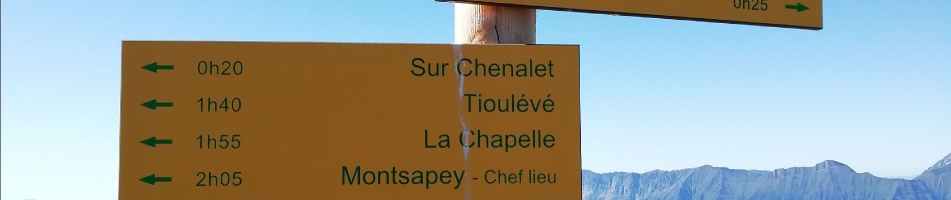
Montsapey - Grand Arc

laurentnecca
User
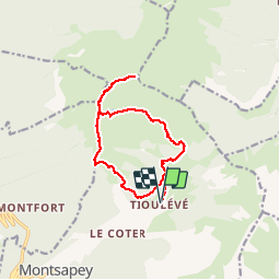

Length
13.8 km

Max alt
2456 m

Uphill gradient
1282 m
Km-Effort
31 km

Min alt
1264 m

Downhill gradient
1284 m
Boucle
Yes
Creation date :
2019-09-12 07:34:36.176
Updated on :
2019-09-12 16:20:33.718
6h39
Difficulty : Difficult

FREE GPS app for hiking
 SityTrail
IGN / Geographical institutes
SityTrail Plus
The world is yours!
About
Trail Walking of 13.8 km to be discovered at Auvergne-Rhône-Alpes, Savoy, Montsapey. This trail is proposed by laurentnecca.
Photos


Positioning
Country:
France
Region :
Auvergne-Rhône-Alpes
Department/Province :
Savoy
Municipality :
Montsapey
Location:
Unknown
Start:(Dec)
Start:(UTM)
294863 ; 5046142 (32T) N.
Comments