


Fillols Cogollio

JeanPierreNancy
User
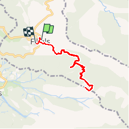

Length
8.3 km

Max alt
1501 m

Uphill gradient
751 m
Km-Effort
18.4 km

Min alt
756 m

Downhill gradient
763 m
Boucle
Yes
Creation date :
2019-09-12 12:28:43.51
Updated on :
2019-09-12 18:45:53.529
5h00
Difficulty : Medium

FREE GPS app for hiking
 SityTrail
IGN / Geographical institutes
SityTrail Plus
The world is yours!
About
Trail Walking of 8.3 km to be discovered at Occitania, Pyrénées-Orientales, Fillols. This trail is proposed by JeanPierreNancy.
Photos

Positioning
Country:
France
Region :
Occitania
Department/Province :
Pyrénées-Orientales
Municipality :
Fillols
Location:
Unknown
Start:(Dec)
Start:(UTM)
451659 ; 4712319 (31T) N.
Comments