


Py boucle du Pas de Rotja

ThonyM
User
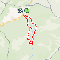

Length
12.1 km

Max alt
1534 m

Uphill gradient
661 m
Km-Effort
21 km

Min alt
983 m

Downhill gradient
660 m
Boucle
Yes
Creation date :
2019-09-26 06:19:44.0
Updated on :
2019-09-26 11:20:10.933
4h58
Difficulty : Difficult

FREE GPS app for hiking
 SityTrail
IGN / Geographical institutes
SityTrail Plus
The world is yours!
About
Trail Walking of 12.1 km to be discovered at Occitania, Pyrénées-Orientales, Py. This trail is proposed by ThonyM.
Description
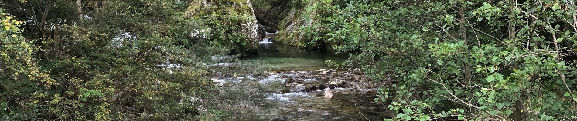
Parfois sportif, quelques fois hésitant à la recherche du bon passage. Attention au niveau de la Rotja pour les traversées
Photos


Positioning
Country:
France
Region :
Occitania
Department/Province :
Pyrénées-Orientales
Municipality :
Py
Location:
Unknown
Start:(Dec)
Start:(UTM)
446574 ; 4704938 (31T) N.
Comments